Monday, May 25, 2009

Table Rock, Connecticut River Valley

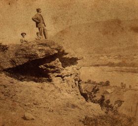
Table Rock: circa 1870


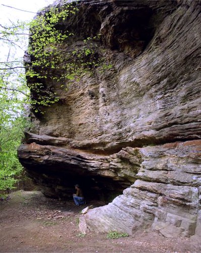
On this excursion into the Connecticut River Valley the goals were more hiking and historic rather than geologic, although the latter is most always inescapably tied in to all I do. Making my way up the old mountain road, I set off to search for Paradise and the Garden of Eden. These names were very much tied to a section of mountain terrain and already in use by the late 1860's where I came across the first written reference. My journey took me over old Kellogg Hill (another archaic name) to one of the Valley's finest vistas - or "prospect" as they use to say. At one site I passed at least a half dozen conglomerate erratics - not native to this immediate area - strewn about as if it were the playground of the Gods - perhaps the Titans. One boulder carried the weight of two trees growing upon its top surface. This whole are is set back above a magnificent escarpment with Paradise - and its beautiful ravine - being it's northern boundary. Finally turning back - and upward - I climbed up into a commanding length of conglomerate ledge where one Giant's face of stone peered down upon me. Making my way the mountainside to my car I regrouped to head into the Garden of Eden. Also setback from a lengthy escarpment the old site likely existed with in cirque - or corrie - several of which exist in this area carved out by the glaciers of long ago. Eventually I passed an outlook with an old survey station marker and reached a spring fed swamp located within the top portion of a double cirque. The outlet for this marvel of nature is a stream that leaps over the escarpment forming a superb cascade. On the return to my car, I did some checking into the walls of the cirques where a partially buried stone wall spoke of times long ago forgotten. The way home - I took the lazy man's approach to Sugarloaf whose road is now open for the season. King Philip's Seat/Lookout, or Table/Jutting Rock as it is sometimes know, has been fenced off for years and views of it mostly hidden by foliage.

Sunday, May 17, 2009

Pulpit Rock, Berkshire Co

Underneath Pulpit Rock

Some of my very best times do not involve a rock - or a cave - or even being outdoors. On one marginal weather day I had the pleasure of meeting the family at a local farm in the central Berkshires to talk over the history of (one of many) Pulpit Rock. Although it never was ascertained if this rock was preached from by a real clergyman, the conversation went on to talk of many sites and bits of history throughout western Massachusetts. Nearby is a (previously unknown) quarry that provided stone to the building of two local churches. I will revisit Pulpit Rock and its caves at a future date for further investigation.

On the way to, I tried my hand at photographing Tory Cave but the stream it lays upon was much too high to cross. In the process I hiked on up through what has sometimes been called Tory Glen. A beautiful example of sylvan wilderness.

Sunday, May 3, 2009

The Bear's Den, Upper Connecticut River Valley, MA

The Bear's Den


For me personally, I have two significant reminders regarding the outdoors during early May: black flies and allergies. With inclement weather rolling around New England, I set out to see just how far I could get on a somewhat gray day. Heading up north to meet with the Mohawk Trail, I then continued my journey a bit farther north ending up at Pelham Brook about 5 miles south of the border with Vermont. The Stone Face/Profile Rock was my goal and I hoped to solve its mystery once and for all. A number of visits to this area, including the local historical society, have been made and finally last Fall a likely candidate was found in a stream side boulder. The first problem (after locating it) are the two postcards depicting it are quite different. Sure, certain shapes and striations on the rock are similar, but that's about it. The rock I gave careful examination to has some similarities with the two images but not enough for me to say definitely this is it. So it seems it will have to remain the likely Stone Face/Profile Rock.

On the return to the Mohawk Trail, I quickly looked into an old copper mine then headed on east into the northern portions of the Connecticut River (or - Pioneer) Valley. Turning north once again, I ended up at the Bear's Den, this time less than a mile south of Vermont. This is an ongoing project to revisit some old sites around northern Franklin County that haven't been seen in a few years and update my information. Bear's Den is formed in argillites where the bedding plane is tipped nearly vertical. Weathering has taken out a significant mass of rock making for a large chamber in the hillside.

Working my way farther south, I ended up again in the location where I've been researching the history of local rock formations in the Connecticut River Valley region. I proceeded to investigate the new set of ledges discovered on my last visit a week and a half earlier. Some natural chimneys, along with very small gravity slide and weathered out shelter caves were found. I've been looking over ledges one by one to see if I can find a match with historical data. On this day, I looked into another nearby ledge in search for "Warner's Ledge", but once again I came up empty handed. Nearby was Etta's Nook, so with the rain beginning to fall, I wandered on in to shoot a quick set of photos for my HDR (High Dynamic Range) project. Castle End is the gateway to this set of ledges and on my way out I did photos for a panoramic picture.