Sunday, July 19, 2009


The Devil's Washboard

Devil's Washboard


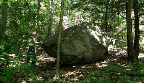
Over the previous winter it was decided to spend time in and around northern Franklin County to mostly revisit old sites for the purpose of furthering my knowledge on the area. Continuing on with this I ended up in the most northeastern section of that County. It is mostly covered by the old Mt. Grace geologic quadrangle, first Massachusetts bedrock geologic map in the USGS GQ series. This "quad", and adjacent areas to its immediate west, cover a wide spectrum of interesting features. Among these are a few caves, a tipping rock, a Wabeek boulder, a chamber, old iron ore and potash mining sites, Indian Kettles, and - my first stop - the Devil's Washboard.

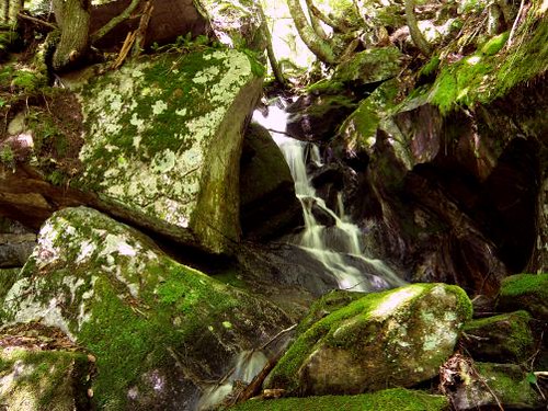
The Washboard is now accessible thanks to the Mount Grace Land Conservation Trust . On the hike in, a small miniature chasm carved in the streambed could be observed just off the trail above the crossing of the brook and wetlands. Eventually this trail ends above Devil's Washboard and it's up to the hiker to pick his way down to stream side. However, one is rewarded with a wonderful waterfall dropping its way down through a natural basin. The whole area, especially upstream, is a picturesque chasm with rock walls. Also just upstream is a 'grotto' or schistose den eroded away in the ledges.

Some years ago I visited the Indian Kettles and thought I'd give it a go at accessing them from a different direction. Although unsuccessful, some of my best finds come almost by accident. I passed by a couple old cellar holes still in fine condition. One has interior partitions (some have called 'chambers') and I've been told it was an old tavern. Beyond was a marvelous set of waterfalls heretofore unknown to myself.

Monday, July 6, 2009

Origins Part II


It was probably early on in the second half of the 1990's while working on the beginnings of a Statewide cave project things took a significant turn for me. While searching though the histories of local towns, I found how significant a part the geography - and geology - played in their past. Later on I discovered how some of these sites had captured the attention of even the scientific community as a search through old science journals will turn up reports well back into the early 1800's. In particular glacial boulders - often listed as "rocking stones" - were amongst these.


Hiram's Tomb - circa late 1800's

Hiram's Tomb - circa late 1800's


Visiting one old favorite of mine, situated in the northwest corner of Hampden County, is Hiram's Tomb. Hiram Smith had a fear of being buried beneath the earth so he had a large boulder, high on a ridge, hollowed out where he and his sister could be interred. Of equal interest is what happened to money left for the upkeep of the land accessing the tomb. It was taken by the individual it had been entrusted to and the tomb now sits in a forest, grown up to surround it.

From Hiram's Tomb I moved on to the former village of Knightville and the dam that has taken it's name from that village. Old postcards depict the gigantic Leaning Rock (aka: Devil's Elbow) laying alongside the bank of the Westfield River. On this day it was well engulfed in foliage and the river running wild with all the recent rains.


'Classic view' of the old rock - as pictured in old area histories; Hampshire County

'Classic view' of Tipping Rock


On into an adjacent town to investigate the R. O. Den where nature has worked Her magic by quarrying away rock out of a ledge to form a small cave. Also in this town the local Tipping Rock which received some notoriety back in the 1800's. This erratic - not large at 38 feet in circumference - lays back in the woods along an old road that once led to a mountain top with a "government survey station". Apparently this station has long disappeared from the face of the Earth.

The road home brought me by Anvil Rock. A somewhat unusual natural roadside ornament lying out in a local resident's front lawn.