Sunday, November 27, 2011

Back to Basics


The old Fern Cascade now known as the Falls on Roaring Brook

A fine stretch of late Autumn weather has allowed me the luxury of returning to old haunts within the Connecticut River Valley. Largely forgotten this past year, it was more due to lack of firm leads than anything else. Mountains and ledges had been gone through, sometimes a multiple of times, searching for the elusive sites photographed some 140 years prior. But the time comes to move on to new goals with the hope of returning to the old one day.

On this day however, it was time to revisit old sites Fern Cascade and the Arch on what wss to eventually be an ascent of Roaring Mountain, lying in the shadows of its slightly taller neighbor Mount Toby. Part of the route I took brought me along the original carriage road that was built mid 1880's to bvring travellers from the nearby railroad station to Toby's summit. A summit house once briefly graced the summit as well. But my path diverged up the Robert Frost Trail and on up a spur trail to Roaring Mountain's summit.

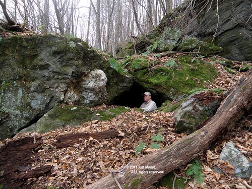
A break for lunch left me with just enough energy for a pleasant stroll down the spectactular set of ledges once know as Graves Ledge. The upper set of ledges with Graves Cave, as well as lower set with all the familar sites beginning with Castle End and running to Fortress Rock were visited. With the foliage now off for the season, a rather interesting, long range photo, of Kittie's Nook was taken.

Enough daylight was reserved so on the return trip a casual exploration in Cummington could be had. Back in 1824 a mineral located in this town was given the name "Cummingtonite". Apparently modern society being what it is today, there is more internet sites devoted to corrupting this into something of a sexual nature as opposed to it's scientific value. However, three locations were quickly checked over (including an apparent old quarry site) without seeing anything that might catch my eye as the mineral.

Sunday, November 20, 2011

Gneiss stuff!


Hikers at the Weeping Wall


Poplar Mountain in Erving MA is (as they say) the "type locale" for Poplar Mountain Gneiss. Erving Conservation Commission (with help from Mount Grace Land Trust) has developed a series of trails that presently run up to the bottom of the Mountain's summit where one can view plenty of the gneiss in the exposed ledges. My hike was with mostly local people, some from the conservation commission, and one representative from Mt Grace Land Trust.

For the following hike, I jumped south across the Millers River and on into the Wendell State Forest. A beautiful walk along a secluded brook, a view of Lynn Falls, and a climb up through the Hidden Valley Memorial Forest (once again - Mt Grace Land Trust property) brought me to some VERY impressive rock ledges. Farther along the Metacomet - Monadnock Trail, one crosses a main forest road with significant overhanging ledges and some 'quasi' cave formations. With the main gate at the State Forest entrance locked, it only remained to walk the road back on out.

Sunday, November 13, 2011

Elsie Venner


Elsie Venner's Cave

Main entrance to Elsie Venner's Cave

What to do with a late afternoon start and a diminished amount of daylight available? With no long drives possible, it is always a pleasure to return to my roots in the Central Berkshires. And one of the stories that inspired me as a child: that of Elsie Venner by Oliver Wendell Holmes.

A small cave in the broken rocks of a schistose mountainside came to be associated with that story. It was one of my early caving experiences and one of my first three attempts at cave mapping. Not a skill I totally developed as it takes as much artistry as technical know how to produce a 'worthy' map.

Little has changed at Elsie Venner's over the 45 plus years I've visited it off and on. The somewhat gray, overcast skies, of a late Fall day made ideal conditions for photographic pursuits. So I came away from my big nostalgia fix with perhaps the most 'worthy' photographs I've take here. Certainly much better than my map back in 1968 turned out.

Tuesday, November 8, 2011

Connecticut


The traditional November excursion into Connecticut took the 'scenic route' out of the southern Berkshires to make a stop at the old Rock Schoolhouse. Slightly relocated, the goal was to identify the rock in an old photograph as being the one that lays next to the former schoolhouse location. That being accomplished - I rolled on to the vicinity of Bristol and Waterbury.


The Rock...


... and the relocated schoolhouse.

Sights taken in on this day were old railroad lines, Connecticut's longest train tunnel, a search for glacial geologic phenomena at Birge Pond. The afternoon was wrapped up at the local carousel museum.

The second day saw the Finch Brook Preserve, Lake Compounce (or - an attempt to access rocky features within), and sections of the Tunxis Trail including a historic graveyard.

Sunday, November 6, 2011

On the verge of closing out another season, it is one that has been most unorthodox for me personally. The number of excursions were cut to include primarily my vacations. And, destinations were mostly the seacoast. All this was in 'the plan' but left me missing some of my more traditional haunts. So with that in mind, it's on to the rocky interiors of Massachusetts with what good weather remains.

A large postcard show out in central Massachusetts brought me into Worcester County. Afterwards, I took on a few small sights in the Town of Hardwick associated with the East Quabbin Land Trust.

Swinging northward, I passed by the entrance to Indian Rock which was mostly snowed in from the freak October snowstorm. The next destination was a back road to attempt a different access from past visits for Shelter Ledge (old Indian Cave) and Rum Rock. A fair amount of snow, and plenty of down tree limbs, made for an interesting hike to the two rocky formations. But after a long night of work, and daylight on the wane, it was time to head on home.