Wednesday, April 29, 2015

Porkies; Old Indian and Clam Cake sites


Two things took precedent on this journey. It was to focus on Rhode Island but also to continue working items that got left behind last year. With that in mind, I added on a visit to eastern Worcester County to finishing checking up on reported caves. And that was where my trip began.


A small section of the old Forester Barnes ledges

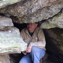
The reported caves (with one reference to "Porcupine Caves") proved to be just that: porcupine dens. A number of them were seen and I'm still going over location data to correlate them in to a map that designated their location. At a previous stop in town, I looked in to 'caves' that have been called Indian Caves. Once again, porcupine dens, although one was actually large enough that some adventuresome person might squeeze in. The local history expert reports a chamber within the ledge, but significant cleaning out of the den would have to take place before even attempting an entrance. The day ended with Indian (Head) Rock and locating a marvelous set of ledges pictured on an old stereoview, described as being on the Forester Barnes place.


Monument to Canonicus

After a night at my favorite campgrounds in northwest Rhode Island, I made my way south along the western edge of the State to land at Harrington's Cave. What followed was mostly visiting rocky ledges/shelters while making my way across the State to eventually land in Warwick. Part of the day's mix included the Devil's Footprint/Canonicus Monument, Queen's Fort, Mt Tom ledges, and Indian Rock/Cave.


Native American shelter

Day three was spent primarily in Rocky Point Park, followed by Drum Rock. The old amusement park is gone but the rocks remain! And there were many photographs taken of Rocky Point over the years. A favorite, simply called The Cave. The Drum Rock visit was only my second, and the first in 14 years. It gave me the opportunity to closely examine the mechanisms behind this Indian signal rock. It is considered to be one of at least two such rocks in Rhode Island rock, Rolling Rock being the other.


Circa 1870 view at Rocky Point - Rock House

Fourth day, was a laid back day. The morning was killed with research at the North Kingstown library. Then a jaunt down the road to see Pettaquamscutt Rock. Before turning home, a thorough drive-by was done in and around Indian Corner for the sake of finding any rock that might match several legends. These include blood flowing from the rock, buried Indian bones and a skeleton on the prowl looking to retrieve his stolen 'head'.

Sunday, April 19, 2015

Elsie


The 'back' entrance to Elsie Venner's Cave.

This was basically enjoying a beautiful day - and tying up loose ends. I needed some definitive information on the site of Elsie Venner's Cave, so took to the woods with pack and equipment. A small amount of ice still prevailed at the entrances. But no surprise, considering the winter we've just been through.


The interior room.

Friday, April 17, 2015

The Return


A long and ugly winter is finally beginning to pass. So lets focus on what can be accomplished in the coming year. Usually, what was left behind from the previous year gets a priority, and that will be worked on as I venture into different sections of Massachusetts and Rhode Island.

But the first trip of this season was focused primarily on the Middlesex Fells, Cape Ann, and few stops in other areas of Essex County. So first stop was Bear Hill in The Fells where the historic Cheese Rock (so named by early Massachusetts Governor John Winthrop) was reportedly located. Generally, it is thought to be Bear Hill, or a ledge of that hill, overlooking to the north/northwest. However, one old book has a picture of it being an isolated boulder. That boulder was not uncovered on my trip, and I move on to the south, and the old Silver Mine.

It took a bit of doing to find the old Silver Mine site, but it allowed me a good look at the local woodlands. I also had a picture off an internet site showing a cave formation of some type in that general area. A stroke of good luck while wandering, took me down a side trail and to that cave formation. Very small, perhaps 3 feet deep on one side and 4.5 feet on the other, it was difficult to tell if natural or man made. No tools marks presented themselves, so perhaps just a weathered rock formation.


Turtle - or Pickerel - Rock at Spot Pond. Early 1900s postcard.

After finally visiting the Silver Mine (long ago capped by concrete), I moved on to an area of the Fells to the east. Old writings mention some of the Fells' largest boulders might be found here. This is an example where aerial photography helped plot my course. Several fine examples of erratics were located, with at least one matching an old Magic Lantern Slide in my collection: the Multiform Boulder. My time in Fells ended with a trip up around Pickerel (aka: Turtle) Rock before heading off to settle in to Gloucester.


The multiform boulder @ The Fells


Pickerel - or Turtle - Rock. Spot Pond in the Middlesex Fells.

The next day I continued on from a previous year's trip, with a more in-depth investigation into large boulders around one of the local reservoirs. It also gave me the opportunity to cross over that reservoir and examine close-up, Cave Rock, first seen last year. This was a huge rock, sitting on a steep shore, with the illusion of a passage beneath. No real passage here as it was a few feet under an overhanging edge with about a half dozen small pieces of broken rock forming a crude side wall. The day was finished out with a quick jaunt on a small section of the Old Rockport Road. Still keeping my eyes open for the Old Man of Joppa but I fear him lost.


Big boulder in the Gloucester woods.

The third day brought me once again to the shores of the Atlantic at Pigeon Cove. Over the Winter a small stash of old photography surfaced depicting sites in the area. One was of The Great Chasm (aka: Chapin's Gully), another of Dianah's Baths, and still another of Dick's Dream. What ended up being most curious (maybe not) was the Dick's Dream photo did not match anything at the previous know location. Also, on old maps of the area, I see Dick's mentioned in two different locations and a different location for Diana's Baths (different spelling) that what is in the photo. Once again, I am reminded "history" is not absolute. The day was finished up in the vicinity of Pigeon Hill where once again I looked for Boiling Spring (nothing!) and took a friend to Profile Rock and Rowe's Tomb.


Dianah's Baths as pictured circa 1870. Singers/Pulpit Rock in background.

My first goal on the fourth day was to locate a possible second entry point to a moraine in Peabody. I was somewhat successful, but entrance would have to be made through a housing complex and that entrance was well populated at the time with maintenance/landscape workers. However, I could see one of the more splendid examples of perched boulders in that area, just outside the perimeter of the lawn, and inside the edge of the woods.


The likely Shoemaker Rock.

I wanted to do some reconnaissance of the Nahant area for possible kayaking adventure around its shoreline. The conclusion here is, it might be somewhat of a logistical night to pull off. I managed to eke out a tiny exploration (by foot) on a section of Nahant's shore, where one old writing mentions a possible cave. Nothing seen by me on this visit. Driving back inland, I stopped by to check access - and visit - the Pirates Glen. Next stop, I found a huge boulder that is the likely Shoemaker Rock I've been looking for many years. Before pulling out of the area, I tried to negotiate a massive apartment complex to find a large boulder in the nearby woods seen on aerial imagery. No luck this time around.


Pirates Glen as depicted on an early 1900s postcard.

My final day was rained on. I set course for home hoping a break in the precipitation would allow me to get out again. Alas, it was not to be!

Wednesday, January 28, 2015

Balancing ... the Unknown.


We have here a mystery rock. Very likely it is not Massachusetts - or even New England. It is identified, but not clear enough to tell exactly where it is. I have gone through hundreds of photos of balanced rocks and still can not come up with an ID.

Can anyone help identify this?


The caption likely reads: near Camp Emmett Crawford, Wyoming

Thursday, January 1, 2015

Year End/Beginning


The year ended/began upon a quiet note. The traditional November trip was made down to Connecticut and involved but a small amount of history, and perhaps even less geology. A stop was made to the local centennial tree, still in pretty good shape for being over a hundred years old. A drive-by to search out a possible (and likely) site of Witch Rock and a return to Rockwell Park. In recent times, the park has returned to (at least partially) filling the old lagoon that provided so much recreational enjoyment to the locals back in the park's early days. An interesting stone tower exists along side the lagoon, and old postcards show it to be an anchoring point for swings and slides. Visited was Crescent Lake, by Chauncey Peak and Lamentation Mountain, which showed some of Connecticut's best examples of trap rock ridges.


Witch Rock around 1900

Some time after returning to the Berkshires, I took up an old project from years past: a stone cross in Connecticut that looked down on the valley below. I first saw it as a child and over the years its exact location became somewhat nebulous. At one point it was even questionable if it still might exist. Making use of aerial imagery, it was 'rediscovered' and my associate made a field trip to confirm it.

Not quite so traditional, just the second time I've done it, was a First Day hike over in Williamsburg. Although it was on the Petticoat Hill Reservation of the Trustees of Reservations, it really doesn't climb Petticoat Hill. A couple obscured lookouts, a high elevation vernal pool, and a VERY rocky ravine with animal dens, were along the way. There is a commemorative boulder at the property's entrance dating this reservation to 1906.


Boulder at the entrance to Petticoat Hill reservation. Early 1900s

Friday, November 14, 2014

Flag Rock


This season looks close to winding down. But still nice enough weather to take on another goal: Flag Rock. This prominent outlook lies on the 'back' (west) side of Monument Mountain. The area was also said to hold some interesting geology as well.


Giant talus and cave formation

The trip did not disappoint. Ascending from the south, Gary and myself eventually found ourselves in an expansive ravine, that more and more showed massive blocks of talus. As we closed in on Flag Rock, an area contained three of the largest pierces of talus I have seen in Massachusetts. Indeed, a couple even boasted cave-like formations underneath. Walls of the ravine contained other cave formations and a free standing pinnacle somewhat reminiscent of the Devil's Pulpit over near the Monument Mountain summit.

Finally arriving at Flag Rock, we enjoyed breathtaking views of Housatonic and the mountain ranges beyond. We then began a steep descent only to turnoff to take in an unnamed cave. I had twice visited this geologic curiosity about six years prior.

Sunday, October 26, 2014

Into the Great South Berkshires


Another journey into the southern regions of The Berkshires. Joining with Gary, from the Great Barrington Historical Society, once again, we journeyed to a far off corner of the aforementioned Town.


Icy Gorge Cave

The Ice Gulch - or Gorge - is a rugged piece of landscape not to be taken lightly. It use to be somewhat remote, as far as access goes, until the 1980's when the present Appalachian Trail location brought it within reach. Nonetheless, climbing through this cliff-lined, craggy formation, strewn with large boulders, is not for the beginning outdoors-man. On this particular day, Gary and myself were content to visit the first couple hundred yards, and peer down beyond into a virtual no man's land of geologic wonder.


The old dam


Glacial boulder with plaque

The remainder of this day proved to be more of a pleasant persuasion. Up the road a ways, we saw a minor karst system with tiny caves and much evidence of underground water activity. And up the road from here was a wonderful old dam and glacial erratic.

Continuing our journey, we dropped in on the local Indian cave, and a park that boasted old mill sites and a small set of falls.

The day was finished up exploring an old mention of a balanced rock being on the back side (west) of Monument Mountain. We did not come up with a solid lead, but within days, Gary and fellow historical society member Bernie, had located a likely site. A beautiful big old boulder but not really worthy of being in the class of balanced rocks.