Tuesday, April 28, 2020

Quabbin Region


I've had a project hanging around for the past five years over in the southern Quabbin Reservoir region and things looked good to make it happen! A small (VERY small) cave was discovered there. But of greater interest was a set of initials/names that had been carved on its walls and dated 1878. Some research from an existing photo led to the possibility that at least one of the individuals responsible was a previous landowner!


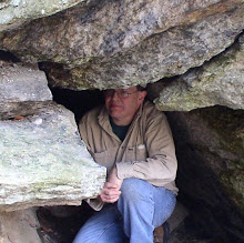
A messy situation waiting at the entrance to the chamber

But let's not get ahead in this story! I started the day looking up the local stone chamber (occasionally called Monk's Caves) which I last visited in 2009. I tried to access the site back in 2015 but the area is covered by dense underbrush. Mostly of a very thorny variety. It never happened on that day and I moved on to another small cave. But the present time brought me back to the area hoping that with the foliage not yet in bloom, I might yet reach the chamber. The short version of this story is I did finally get there! But at the cost of plowing through a considerable forest of prickly growth. I was shocked upon arrival to see the chamber's exterior completely engulfed by the growth and only recognizable from a few feet away. Time was spent gathering a new set of photos and seeing little (at least on the inside) had changed over the past 11 years. I did not relish the thought of traversing the prickly forest once again to make my exit but luck was with me. About a third of the way out to the trail, I came upon an area that was somewhat more open than thorn covered vines. Success!


A little more cozy on the inside!

Moving on, I arrived at the parking area for the large react of land I would have to cross to hopefully reach my destination. The site had been successfully located - and explored - late last year by eminent explorer Mike "Rhody Mountain Man" G. It would be impossible to overestimate how much 'easier' that would make my trip. A long walk later - only to find I had incorrectly entered GPS data - I made the necessary adjustment and finally arrived at the cave. It is a curious item. The ledge had been obviously shaped by the forces of weathering with a large talus slope out in front supplied by the disintegrating rock. But of greater geologic interest, was the appearance of possible solutional formation of the tiny cave. So I set about running quite a few tests with my bottle of acid. Initially, I got all negative results. But before leaving the scene, I went deeper into the cave and tested a number of locations along its walls. Positive! Even though I was able to get a pretty good fizz at one location, and a lighter reaction on the opposite wall, this confirms the presence of carbonate rock. And the possibility this cave was a lens dissolved out of the parent rock.


Clough Cave

At this point, it was time to call it a day! I drifted down to the Turnpike and back west to the Berkshires.


Wring by Clough & Co.

Wednesday, April 15, 2020

Lee - Lenox Rambles


Seizing the opportunity to work a lead generously offered by Mike (Mr.) T., I headed out to the Central Berkshire region of... Lenox! Yes, I occasionally do some stuff that is almost in my own back yard.


Big piece of Lenox Mountain

So anyway, some boulders of VERY large proportions were deposited near the base of Lenox Mountain. The largest of these having a circumference of 166 feet! Height could very well range from 15 to 18 feet depending on the location of measurement. The first was approximately 12 feet vertical, then sloping back to the rock's summit. There is one nearby with almost as much circumference but lacking a bit in height compared to the Big One. I noticed on my GPS waypoints the Balance Rock in Kennedy Park was not too far off. So I finished this trip visiting a park favorite which I had not seen since the later days of 2002.


Kennedy Park's Balanced Rock

A day later, I joined South County's Gary L. for explorations in Lee. We started out in East Lee at the trailhead to Donato's Trail. This is right alongside the famed Jacob's Ladder Highway. This one ended up being a steep climb, and we decided to do a 'summit circuit' which made the approach a bit longer. However, the descent back was much quicker and shorter in distance. Without the leaves yet on the trees we got a slight glimpse of Goose Pond below.

Peter's Cave - from an old Lee Chamber of Commerce booklet

Moving our act closer to the center of town, we took on Fern Cliff and locations there, written - and pictured - in the local history of the area (my own history was late 2003 for the last visit). These included Peter's Cave, Union Rock, and The Trysting Place. Peter Wilcox's cave made for a good yarn in Clay Perry's books on New England caves. While other sites on the cliff (including Peter's) was the subject of photographs in Picturesque Berkshire South (1893).


Union Rock

Monday, April 6, 2020

Catamount! The Caves, the Marbles, and Other Things...


There's a little piece of Heaven that exists, just south of the Vermont border, in the Town of Colrain. The Catamount Hill(s) were first settled around 1780, mostly abandoned a century later. Geologically, much of this area is underlain by the Waits River and Goshen Formation, parts of which were formerly called the Conway Schists during the late 1800s by eminent geologist B.K. Emerson.


View out of the Bear's Den

As far as the interests of the amateur speleologist and geologist might go, there is the presence of marble/limestones to be found in these old Conway Schists. And even furthermore, one of three 'major' caves in the Catamount Hills may have been formed within those marbles. But on this particular day, conditions meant hiking in a ways to my first objective: the Bear's Den.


The interior of the Bear's Den

The old roads are often flooded due to poor drainage and beaver activities. The Bear's Den is a major rupture in the ledgy hillside that has formed a separation - and cave - of good size. At just over 50 feet, this is a good size cave for these parts! Enjoying my first visit to this area since 2006, I eventually moved along to the area of the Catamount Dens and the Oven. Along the way, occasional outcrops of the grainy black marble could be found. Even popping up in the middle of the roadbed.

My long-ago past visit to the Oven did determine a small presence of marble, thus providing evidence of a traditional solutional genesis. However, I had a nagging feeling over the years that I'd like to see more than that. Between photography and running several dozen tests on the surrounding bedrock, this ate up the lion's share of my time this day. But it was worth it! A much greater presence of marble was to be discovered, furthering the evidence of this cave being a rare formation in Massachusetts, outside of the Berkshires!


The Oven

Packing up, I moved a short distance 'down around the corner' to the Catamount Den(s), proper. This very impressive collapsed ledge, sports a good size talus cave. It also appears to be at the head of a major drainage that probably dates to around the end of the last ice age. This drainage was eventually followed down to McLeod Pond. Of interest here, were some significant outcrops of marble. These seem to extend out into the water but I'd need water access to confirm that.


At the Dens

It only remained (yeah - right) to climb out of the area surrounding the pond to access my route back to the car. This proved more difficult than anticipated and I eventually arrived ending a VERY long - but enjoyable and productive - day in the outdoors. Then the long drive home.

Methodism in the Hills "Another sect appeared in this area when the Troy Conference sent missionaries to Rowe in 1800. There they succeeded in forming a class of a dozen members that became one of the circuit which included Catamount Hill. The Methodists did not believe that buildings were necessary for their purposes. Meetings were held in groves, caves and barns. The Hill meetings were held at the Oven Den and in the newly erected unhewn log school house. Twenty years later the Methodist Reform Church of Colrain was organized by the leading men on the Hill. One of the preachers was Doctor Pardon Hayes of Rowe."

The Puzzle of Catamount Hill (1969) by Elmer F. Davenport

Wednesday, March 18, 2020

Awakenings: The Sequel!

A week later, I returned to the same basic range of mountains just east of the Connecticut River. This time it was to explore more southerly sections of the 'old Park' and reacquaint myself with the locations first studied over 15 years ago. And yes - the photography of Amherst's John Lovell figured prominently into this.

Several old mountain roads lead upward and trails often diverge from these roads. My first jaunt took me up through an area once occupied just past the mid 100s by the Ansel (A.C.) Delano sawmill. Beyond that, an area existed (not overgrown as it is today) called Paradise. Here I found several good examples of conglomerate ledges and very close by is one used by climbers called The Sunbowl.


Silver Cascade

Returning to my starting point, I relocated bit a bit to the north and hiked up the mountain via another old road. Here was a pretty worthy cascade that I believe photographer Lovell called Silver Cascade. It's not far from an old sugar house that once belonged to Nathaniel Smith. A magnificent glen lays below this cascade and might be the one portrayed in the old Lovell photography as Mossy Glen.


Looking down through the Grand Porch

The remainder of the day was put in at a better know set of ledges once called The Bear's Den - or Home of the Rocks - that is covered in 12 different old stereoviews. My first stop here was at Russell Rock which is a relatively new photo to my collection. It can be found between the Kitchen and Pantry, and the Curve Rock. Finishing up here, I moved on to the area of the Grand Porch which seems to mark the entranceway to Titan's Pasture. I worked my versions of photography for the Porch and the beginning of the Pasture. On the way back, I had enough time to quickly snap Old Man Titan, a giant facial formation that watches out over the Valley in the vicinity of the Rock Shadow.


Old Man Titan

[For those wishing to explore some old-time geologic writing on this area, I would refer them to the "Cirques and rock-cut terraces of Mount Toby" by B.K. Emerson. This can be found in GSA Bulletin (1911) 22 (1): 681–686.]

Monday, March 9, 2020

Awakenings!


It's a little early to tell if a genuine Spring is in the offering. But why look a gift horse in the mouth when a perfect spring-like day is offered to you?

So where to start with all the many choices. It was decided go with my long running activities n the mountains east of the Connecticut River. It proved worthwhile as I was able to solve the 'mystery' of one old John Lovell stereoview sold to me as the Pulpit Rock, but in reality was Grave's Nook.

The Cave as it appeared circa 1870

But the day began up at The Cave, high in the fractured conglomerate ledges, about a mile east of the River. Along those same ledges the Pillar could be found, a tall spire of rock that has separated from its parent ledge. Somewhere along here, another stereoview from my collection, depicted a scene know as "Approach to the Cave". However, its exact location could not be determined. The long way up and around these ledges brings one above The Cave to The Ditch. This 'open air' formation is an integral part to Cave's formation as the splitting bedrock is cause to both of them.

The Ditch

After moving on to Grave's Ledge, I quickly passed by all the old sites identified in past excursions including Castle End, Etta's Nook, Rock Roof, Rock Bend, Kittie's Nook, and Pulpit Rock to arrive where I wanted to focus my attention. Here we brought up the image of the 'second Pulpit Rock' stereoview and shortly identified it as Grave's Nook. A good view - at least for photographic reasons - was almost impossible but I captured it as best I could. Then I focused on capturing images of formations obtained in my last purchase including Myra's Retreat, Tripe Lichen Ledge, and Titan's Quarry. Per usual, I worked in updated photographs of some old favorites. In this case: the Twin Slabs.

Titan's Quarry

Time seems to pass all too quickly when one's busy on such an enjoyable day! The identification of Grave's Nook provided an extra bonus in that it finishes pinpointing the location of all John Lovell's photography for the Grave's Ledge section of his "Views In Sunderland Park".

Myra's Retreat as it appeared circa 1870

Friday, November 22, 2019

Return to the Southern Berkshires/CT


Late into the season, we go back to a site first seen a few weeks ago: Tipping Rock in the Southern Berkshires! Gary L. from Great Barrington wanted to see this old relic photographed by F.W. DeMars of Winsted during the early years of the 1900s. Arriving at the venerable old rock, Gary did a clean up of the usual forest debris one might find on and around the rock We then set about creating our own versions of the 'Then' and 'Now' photographs. From there it was on down to the Colebrook River Lake, which was running pretty low. The well know bridge (visible at the lowest water levels) left over from Colebrook's early days, has been removed.


Hanging Mountain - from a distance

Down into Winsted CT, we cruised an area that likely will be used as a future access to Robbers Cave. Then it was slightly to the west, checking about for anything that might fit the name of Perch Rock along Highland Lake. Several sites were checked out including a couple Dog/Snoopy Dog rocks. An antique shop and lunch rounded out our time in Winsted. Then it was up into the northwest corner of the Nutmeg State for a quick excursion through an old lime quarry and its prolific deposits of crushed limestone. Two more antique shops in town finished out our time in Connecticut and we returned to the Southern Berkshires along old Route 7, passing Mount Petra marking the gateway to downtown Great Barrington.


'Snowy' looking scene in the old lime quarry

Thursday, November 7, 2019

Tekoa!


Finishing out RMM's last full day in the Berkshires, we took Jacob's Ladder Highway out of the Berkshires! Time had come to introduce Mike to the rugged cliffs of Mt Tekoa, overlooking the Westfield River and the Massachusetts Turnpike.

I had not been back here in many years and was not entirely sure we could find my old haunts. But with a little poking around the lower limits of talus was found, along with several small cave formations. Greatly perplexing was the apparently loss of a massive lean-to slab that formed a nice cave right along the base at one of the cliffs. I can only imagine Mother Nature reclaimed it in some large scale movement of the rocks. Of interest is a persistent legend of a Counterfeiter's Cave existing somewhere in the Mountain! No one that I know of has ever confirmed this.


Mike exits a lower entrance of a talus cave

With rain moving in, we made our down the mountain and back to Lee along the same route we took earlier. Passing through the heavily mined town of Chester, the picturesque Huntington, along with Becket. All towns greatly explored over past years. In Lee it was time to say goodbye with Mike planning a solo adventure the next day on his return to Rhode Island. But that is a story for another time!