Monday, August 24, 2015


Returning to the Land of Quabbin gave me an opportunity to reconnect with the East Quabbin Land Trust. They were having an open house at a recently purchased farm that also happens to be the location of Bell Rock. This was visited as part of a guided tour. Previous to this, I landed in Barre to further examine a reference to the Stone House and hike some Trustee of the Reservations land.


EQLT at Bell Rock

The Stone House reference comes by way of an old map. Although there is a small rock shelter in this area, I am of the mind it refers more to an imposing set of ledges nearby. The section of ToR land was new territory for me, although MANY years ago I visited the Indian Grinding Stone on this same property.

A night's camping, then it was off to Royalston. I got in my first visit of the famous Royalston Falls, preceded by seeing another site from my long ago past: Profile Rock. The day was finished off with a visit to the local library where I scoured old records for other sites of interest.


Profile Rock

Friday, July 24, 2015

Tri-County Marathon


Dry summer heat has returned. So what to do? The water! For some time, I've had several postcard images of a very large lake in eastern Worcester County. A lake containing quite a few rocky islands. With the appropriate access in hand, I set upon the water investigating each island, often with summer homes upon. Some pleasant paddling, but little at this point that I can positively identify of the old images. I suspect one - Bennett's Rock - may be a shoreline feature and that would require a much more extensive search.


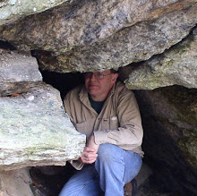
An Indian cave (shelter) in Middlesex County

Later on that first day, I was very excited to locate a Middlesex County Indian cave that has long been lost and even thought destroyed. It is not much of a shelter, really just a split rock that has shifted and formed a small overhanging area. Afterwards, I visited a nearby similar - but smaller formation - that I first uncovered years ago, and originally thought might be the aforementioned Indian Cave.

The day was finished up with a quick trip into the Middlesex Fells expressly for the purpose of photographing one particular side of the Multiform Boulder seen during my April trip. The photo confirmed the second of my two antique glass slides, as being the same boulder.


The 'Multiform Boulder". From a late 1800s glass slide.

The second day was kicked off with a social visit to an area friend, checking out a kayak put-in I would use later that day (towards high tide), and a visit to Rafes Chasm. Since it was getting towards low tide, I carefully picked my way over to the Flume for some close up photos. Just before mid afternoon, I returned to the general area to do a kayak launch. My paddling took me out - and southwestward - for a look at several small, rocky islands. I was rewarded with a couple of small sea caves and an arch.


Sea arch formation off the Essex County coast.

A light schedule on the third day. I moved up to the north to check out their local Devil's Den, which recently, has come into the public domain. The Devil has a pulpit in the immediate area as well. The whole trip was finished off on the next day looking over some area conservation land that promised significant ledges. I barely scratched the surface here with bugs and heat being oppressive. So I removed myself to Thoreau Country (back in Middlesex County) to check on a future kayak put-in to explore some of Henry David's old haunts.


The Devil's Pulpit - hidden amongst the brush

Friday, July 17, 2015

Between a Rock and a Hard Place - Or a Frog and an Indian.


I've been wanting to head down into northwest Connecticut to finish up a search for the local Indian cave. And since I was heading south, a good time to investigate Frog's Landing. It was brought to my attention, in recent times the poor old froggie of Frog Rock fame was inaccessible.


The Frog - of Frog's Landing

Even though the Frog was mostly shutoff from easy access, I managed a way in. Then on to Connecticut where I tried an alternate route to Indian Cave. This proved to be a no go as I battled through dense growth which included much thorny brush. I eventually abandoned this approach, and returned to the original, attempted, access point visited last fall.


Eastward looking view of the Cave

Even this proved no easy feat, but bushwhacking and fording a stream brought me into a beautiful area of sylvan wilderness at the base of a mountain. Ledges at the base of that mountain contained the sought after cave. A weathered cave formation, it proved quite spacious at almost sixty feet long and up to twenty feet deep in one section. A couple fire rings gave testimony to it not being totally forgotten.


Westward looking view of the Cave


Thursday, June 25, 2015

Pinnacle of (half) Success!


18 years is a long time. But I try to get back around to sites that have not been visited in a long time. Especially, if there's something new to be gained from such a visit. The Pinnacle is a local (and not official) name to an elevation in central Berkshire County. There is also a 4 acre parcel on that site belonging to a area land conservation group.


Entrance to the cave @ Pinnacle.

So, it was my intention to revisit the two caves located at the Pinnacle, and to see in what proximity they may be to conservation land. In the end, I was only half successful. The smaller (and less important) cave remained unfound. This despite the fact I considered it the easier of the two to find. However, while giving careful inspection to a significant run of ledges, the 'major' cave in the area turned up. High in the ledges, a cave formed by fracturing and movement of large pieces of rock, or whose formation is described as tectonic, in nature.


Interior of the Cave.

As for our "lost" cave - that's for another day.

Tuesday, June 16, 2015

Get the Lead Out!


Long have I heard about the mining of lead - or more accurately galena, the ore it's derived from - down in the settlement of Loudville. An opportunity arose to visit that site as part of a geologic history tour. Locations visited on this day included an air shaft, tailings pile, old water course for draining a (closed) adit, site of a reverberatory furnace, and site of the processing operations.


Ruins of the firebox to the old reverberatory furnace

Thursday, June 11, 2015

Almost Quabbin


The time has come to work more, in and around the Quabbin Reservoir region in Massachusetts. Unfortunately, once again, the hot sticky weather has descended upon us. Something I do not tolerate well and only serves to limit this guy's activity.

So setting my sites upon the Belchertown area, I began with familiar territory. In the ledges near the town's three lakes is a 'weathered' cave formation. Not terribly deep - or impressive - but a lot going on in this area geologically. It will give me more to ponder during the off season, during those times I retreat to become the 'armchair adventurer".


Juniper Cave - weathered cave formation

I took a quick spin by the location of the town's stone chamber. Not surprising, the access was buried behind significant brush, some as tall as eight feet and VERY thorny. I've seen it once this way previously, and the only time I've accessed it was sans foliage. Even then it was a bit of a 'thorny issue' picking one's way through the brush and vines.

My final site was a local wildlife management area. There is a small cave formation here (looks to be another weathered formation) with three names from the 1800s inscribed in the rock. Some pleasant walking but the exact location was not known, and consequently not found on this particular trip.

Wednesday, June 3, 2015

High above Housatonic


On this day, I returned to the far side of Monument Mountain, high above the village of Housatonic. This was to follow up on last November's trip, to the same area, with a more in depth look at some of its features.

Almost 500 feet of elevation later, I arrived at my first site: what appeared (from below, and a distance) to be a 'window' (cave?) in the upper ledges. Climbing up through the talus slopes, I eventually arrived. Unfortunately, the image seen from below is more of an illusion. The reality is a huge, detached piece of ledge that had shifted forward. It left, up in back, the parent ledge with an overhang. No real cave present, except for a crawl down under the gigantic piece of rock that had come loose.

Moving on, I eventually reached the site of several enormous boulders first investigated last Fall. These are massive pieces of rock with the two laying beside the trail each measuring well over 100 feet in circumference. The position of each is such that a sheltering cave lies beneath.


The backside of 'Pinnacle Rock'.

Just above these two boulders, is another enormous detached piece of ledge. This 'pinnacle' of a rock has not moved far from the original ledge that spawned it, but one can walk completely around, although some tough footing is to be found. In the immediate vicinity is an impressive section of ledge, fractured and slightly dislocated, to provide at least one small tectonic cave.


Tectonic cave