Friday, May 20, 2016

The Mighty Connecticut


It was six years ago I began my adventures into kayaking. Early on, I had intended to visit the basalt formation at Titan's Pier. So many years later, I finally got around to seeing this unique, and interesting, geologic formation laying along the mighty Connecticut River.


Titan's Pier - early 1900's postcard

The conventional wisdom is to start a river adventure paddling upstream and that way you can take advantage of riding the current back on the tail end of your trip. However, with limited put-in possibilities, this had to be done in reverse. Titan's Pier was not far from the Oxbow put-in and quickly sited within the first quarter hour. After photos and an examination, it was decided to continue downstream and visit the dinosaur footprint park.


Titan's Pier - columnar basalt formation

The 'dino prints' were still a good distance to the south, probably about an additional three and a half miles. After putting to shore and disembarking, the site was visited. Then began the long paddle upstream which would eventually return me to the Oxbow.

Thursday, May 12, 2016

Blackstone: The Sequel.


Continuing on with investigations into the Blackstone Valley region, several towns in its northern region were picked out to work an accumulation of information I had in hand. During two days, I pursued the report of a Dead Man's Cave, House Rock, and Shelter Rock. Library and town hall visits got the ball rolling and I await further information from a couple local sources. A drive by in the approximate area House Rock is reputed to be in, did turn up a massive outcrop of rock.


Shining Rock

Visiting this area, allowed me to drop in on several sites first visited long ago. These included King Philip's Lookout/Lookout Rock and cave beneath, Shinning Rock (old quarry site), and a cave that came to light approximately 15 years ago. The cave was in an area threatened by development, but appears safe for the immediate future.


A cave entrance in the Blackstone Valley

Ending the two day trip, was an extensive search of the woodlands above the Rhode Island border for a rock shelter mentioned in an old archeological report. Numerous rock ledges were looked over but no positive id was forthcoming.

Thursday, April 28, 2016

Blackstone!


It has been a long time since a dedicated visit to the mighty Blackstone Valley. Oh - I do go through there on occasion, as a route back and forth to Rhode Island. And not long ago, about the only caves found there was the Purgatory Chasm series. More modern times have added to those. And it does depend on your definition of the boundaries for the Blackstone River Valley.

A recent lead brought me into the Valley about a dozen miles from Worcester. A stop at the library, and a connection with a local man, gave me the information I needed to pursue that lead. But first - a second visit to Upton's Stone Chamber (sometimes referred to as a 'cave') which is perhaps the best know of these structures in the Northeast. A lot of water in the main room so only a cursory examination could be made.

Next up, was also a second look, at a heavy area of talus on Peppercorn Hill. There are stories of Indian cave(s) here and I did a pretty thorough search a couple of September's ago. However, recent information gave a 'more definitive' location. This ended up being the same major pile of talus I had gone over before, and nothing of any additional significance showed itself.

Moving on, I wanted to look up the first burial ground in Town. Not too much trouble locating this and in the same general area was suppose to be a boulder. A rock mentioned in the WPA's Massachusetts Guide published in 1937. The boulder turned up visible from the same location I parked to hike in to the cemetery.


The 'W.P.A. Boulder'

Day one was finished up looking up the cave location and a good find it was. Looks to be two separate caves in the bottom of a small ledge. If this is indeed the correct location it would be Rattle Snake Cave, of which only one reference, have I found so far.


Cave discovery!

The second day was kicked off looking up an old site from long ago. Indian Cave, whose claim to fame were Native Americans using the area to harvest quartzite. Occasionally this cave has been know as Quartz Cave, along with a couple other names.


The Indian Cave

The remainder of the day - and trip - took me back into Rhode Island. The Cobble Rock area was visited, particularly to look over other rocky formations in the area. Connors Farm in Smithfield was checked out before heading home. This fine piece of conservation property was said to have 'caves'. What cave formations that may be here, are VERY minor - at best.

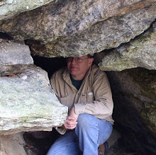
Wednesday, April 20, 2016

Great Barrington to Red Rock


Back to the southern Berkshires with master of south county history, Gary L.. Two sites in Great Barrington were looked at. The first was a split rock along the Appalachian Trail (very minor formation) and a BIG boulder not far from the ski area.


The Butternut Boulder

We followed with a visit to Red Rock, NY and its namesake rock. Tradition has it the rock was painted red so the town would have an actual 'red rock' to name the town after! Around 1860, a marble obelisk was placed upon the rocky summit.

Saturday, April 16, 2016

Greenfield to the Berkshires via The Mohawk

A chance to drop in at another postcard show. So Off to Greenfield I go. Not too bad a selection of cards, and afterwards, the opportunity to visit the local Bear's Den.


Out of the Bear's Den

Using a bit of an unusual route for my return to the Berkshires, I took the Mohawk Trail all the way to North Adams. However, before descending the big mountain down - and around - the hairpin turn, a stop was made to take in a really big boulder. This one lies pretty much on the boundary of Florida and North Adams. Right around 70 feet in circumference, and 14 feet high, this appears to be a big chunk of granite lying about an area of mostly schist. So a true erratic, indeed!


Boulder at the boundary

Thursday, April 14, 2016

Colebrook


The early photographic work of Winsted CT's Frank W. DeMars (late 1800's to early 1900's) does leave an interesting body of work. It also leaves some sites needing to be searched out. One such one is Pulpit Rock in the Robertsville section of Colebrook. A local history source narrowed down the location for me last year and on this day I set off.

Accessing the area took a bit of planning but soon I arrived in an area of ledges and rocks, apparently peeled off of those ledges. The photographic image we have to work with is not entirely the best but I felt enough there to identify it. A good search of the area was made, some pretty fine boulders visited, but Pulpit Rock itself was not identified.

On the return home, still in Colebrook, I stopped by another large boulder. This one marks the site of where a local schoolhouse once stood. That schoolhouse exists, but has been relocated to an adjacent plot of land.


The old schoolhouse rock

Saturday, April 9, 2016

Balance Rock & Boulder Fields


A quick spin by one of New England's most recognized boulders: Balance Rock in Lanesborough. I recently received an antique photograph from a friend made some years ago in Eastern Massachusetts. Probably early 1900's, it showed a man standing upon a rock. It was a long shot that it was taken in the area of Balance Rock, but I checked out that possibility anyway. Sadly, to no avail.


The unidentified rock

Working a tip from a local caver, I journeyed on to northern Berkshire County. The results were quite remarkable. A series of ledges, while down below, boulders of a remarkable size. A couple of these will easily be among the largest in the county.


One of the larger boulders at the boulder field