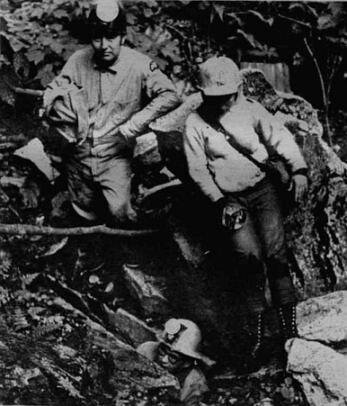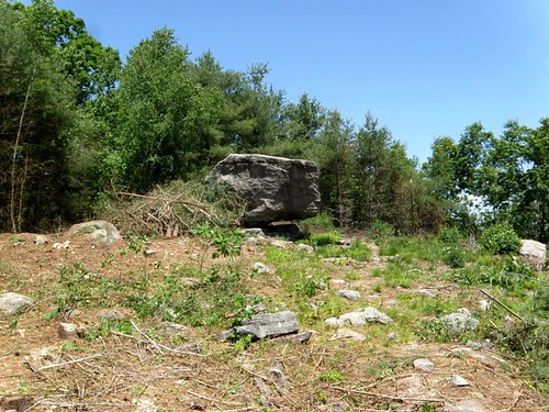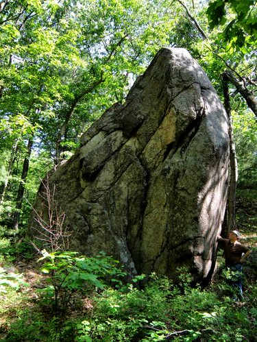
The PinnacleThis adventure begins where I began my April vacation - on Massachusetts State Forest land, just above the Rhode Island border. Taking on a different section of the Forest from where Boulder Cave lay, I returned to two small but interesting cave formations. The first would barely be human sized but has a smooth, worn passage somewhat reminiscent of a solution cave but likely is not its origin. Right nearby is 'another' boulder cave (this whole area of State Forest land is replete with glacial erratics)but with a definite 'passage' underneath. Here we have a huge boulder with just the right dimensions, setting down on a ledge, providing the small cave underneath. Also nearby is, what I have named, the Pinnacle, a giant spear of rock standing straight up at least 20 feet high. A casual look seems that a large, somewhat flat, erratic was left standing on what was previously its side. After clearing out of State Forest property, I took one more look for the cave formation in town that I failed to find back in April. This time it was a success and it lay amongst the red and purplish rocks indicative of (what is now mapped as)the Blackstone Group in these parts.
Working my way south adjacent to the Rhode island Border, I visited a splendid balanced erratic and 'boulder den' (cave-like formation) within a local park. More of the reddish rock was present on the face of the Den (it might be noted that a nearby area is documented for an occurence of red limestone). Turning east away from Rhode Island, I cruised on into a town holding a superb example of the Devil's Footprint formation. This set of footprints comes complete with story of a local man and his pact with Satan. Finishing out my day on the other side of town was one of the several King Philip's caves scattered around Massachusetts. Heading down deep into southeast Massachusetts I found my campground
closed but a quick phone call confirmed sites available at another State Forest farther down towards Buzzards Bay.

Minister's Rock: early 1900's
Sliding Rock: early 1900'sDay Two was to be primarily coastal towns starting in the western Buzzards Bay region and heading west from there. My first stop: Minister's (occasionally: Pulpit) Rock. Also seen in town: a split rock formation that made at least several appearances on early era postcards. I had been told by the landowner on a previous visit, Calvin Coolidge and Warren Harding posed by this boulder for a photograph long ago. In the next town west I drove by a giant pair of rocks visited on a previous trip know variously as Great Rock, Split Rock, and even Big Rocks but my investigation took me nearby to another reported "Great Rock". Located on a local golf course, I was graciously granted a tour of the surroundings, including the rock which they call Split Rock - yes, another! Afterwards, a direct line was made south to the coast in search of the Sentinel, a rock sitting off the shoreline portrayed on another old postcard. One more town west and a look for two features mentioned in local history writings: Leanto Rock and a Devil's Footprint. A thorough search revealed nothing definitive on these reported ahoreline area features. It is not usual for seaside rocks to have shallow, cup-like depressions and to say one is the footprint without further knowledge would be impossible.
I decided to bypass a few things on my list and continue directly west to Fall River where Sliding Rock lay waiting in a local park. While in town, a long overdue return to the famed Rolling Rock (one historical reference: Goose-nesting Rock) which is now the "official glacial rock" for the State of Massachusetts. Just outside of town, I stopped to visit an old friend/eBay dealer and great source of information on the local area. Nearby: an alternate access route was scouted to another King Philip's cave. On the way back to camp, I did a drive by check for a route to Joe's Rock and finished the day at the local library.
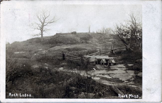
The rock ledge from which Rock, MA takes its name. Early 1900's postcard
On a somewhat abbreviated third day, I journeyed up the Rt 495 corridor to investigate the origins of the Town of Rock (got to love that name). Along the way, a trail was discovered on land trust property that covers roughly the area that lends the Town its name. An old quarry site (and modest example of a 'footprint' formation) were present. I believe the location was found for a couple old postcards but will have to work this a bit more for further confirmation. I finished the morning, before heading home, in a neighboring town looking for a couple Indian ovens (rock formations) but a lack of definitive information made them impossible to locate. However, I did leave town with knowledge of possible contacts that may help. Location information can often be a long process.