Sunday, December 6, 2009

Epilogue


With the arrival of snow and cold in the Berkshires of western Massachusetts, the end of another season comes to a close - at least as far as this explorer is concerned. The yearly hiatus is a chance to rest from the travels of the past year and to plan for those of the coming. Does not mean I won't be poking my nose out the door on occasion but that will be the exception rather than the rule. For those interested in continuing to see new information, I would direct you to the basic, long running (almost twelve years now), version of my website Jim's Page. An ever changing selection of images rotates through this site as opposed to the blog where a few static pictures remain on display.

And speaking of this blog, it is fairly new at less than a year old, but started as an experiment - an experiment I intend to keep on with. Earlier this year I archived past adventures into it and hope to continue on with that. Another possibility is to use it as a forum for writings other than just documenting trips. This - to some degree - could replace the assortment of web pages that once were connected with Jim's Page up until earlier this decade.


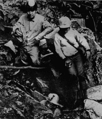
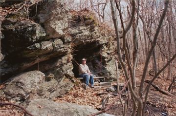
Author exiting Ladder Cave
Photo by T. Hoffman mid 1990's

Sunday, November 29, 2009

The Grand Tour


An unusually wet Coon Hollow Cave entrance

One other trip I wanted to get in before the inevitable end to this year's outdoor season was a tour of a large section of karst within the central Berkshires. It is one of the more amazing pieces of geology in Massachusetts, from the speleological perspective, with a least a dozen solution formed marble caves located in a 'corridor' just over two miles long.

Taking my usual back road approach, I traveled down through the northern portions of this 'cave corridor', turning into the less inhabited woodlands, to finally come out overlooking the side of a valley. Several mountain streams drain down the sides of this valley setting up a classic cave karst scenario where waters flowing off the less soluble schists, onto marbles, eventually makes it's way underground. Not far from these 'contact zones' is often a likely site that caves might want to form. It this particular area three caves - Coon Hollow, Dolo, and Coffin Caves - are diversionary routes from the surface streams. Sometimes the surface stream beds (or sections thereof) run and sometimes can carry running water.

My first destinations were Coon Hollow and Dolo Caves where one might say they are geologically connected if not physically. They are both underground channels for the same surface stream. On this day, waters were high and normally dry sections of streambed were carrying water - right on into the cave entrances. Moving on to another section of forest, a second stream draining into the karst lands was also running water in sections not normally found and right by the entrance to Coffin Cave. Descent into the caves under these conditions would be ill advised. Somewhere within the earth the hydrological flows of the two cave systems, Coon Hollow/Dolo and Coffin, do meet and exit through a major spring - my next stop.

Waters from this spring travel a ways down through a beautiful section of wilderness and on into a geologically separate section of karst. Paralleling close to the main stream is one running underground where a small section can be accessed through Blanket Cave. Eventually a couple hundred feet farther along - much further than one can travel through the cave, the underground waters issue forth and travel somewhat alongside the main brook. Eventually a second stream coming from a slightly uphill resurgence joins the Blanket Cave stream. And even farther along the hillside a third resurgence can be located.

Some of all this 'resurged water' comes from an upland plateau of sorts - another less obvious example of karst topography. Waters coming off the shoulder of the valley highlands do eventually make their way underground upon the plateau, in the insurgence once know as Temper Hole. Beyond Temper the plateau exhibits characteristics of underground features with sunken ravines and sinkholes.Most of these features end in the area where Bill Blankey's Cave is found (whomever Bill Blankey is/was - is lost to time) preceded by newly discovered Skeleton Cave found higher on the ravine's wall.

With all caves visited and accounted for, it was only left to make my way back up and out the valley of karsts. Returning to my car I find an eager group of orange clad men pouring out of their SUV in preparation for the next day's beginning of shotgun deer hunting season. Retracing my route home by way of the woods road, I passed more streams diving into the ground providing warm memories of past excursions into the nether regions of this expansive karst.

Sunday, November 22, 2009

Monadnocks and Pulpits


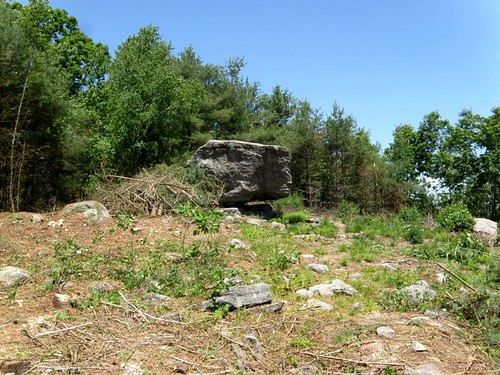
Pulpit Rock: circa 1870


The gray, cold skies of late autumn portends the coming of winter but offer up some of the best outdoor experiences of the year. Before closing my season out for another year, I wanted to visit the rocky formations within the Connecticut River Valley one more time. Having such a beautiful day this late in the year is certainly a gift not to be taken lightly so I extend my journey to climbing Mt. Toby.

Toby is a monadnock standing close to the mighty Connecticut River. I used one of the old mountain roads that comes in from the west ascending past a fallen in sugar shack. The last one-third of a mile provides a nice challenging climb of about 450 feet in elevation. Views on the summit are quite limited until one climbs the fire tower (seen from the valley on the drive in) and is rewarded with a breathtaking vista. Leaving the mountain top, I checked the remains of the sugar shack seen on the ascent (just downhill from here a couple of faults trending south to north run through the area) and looked into a couple side trails.

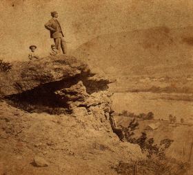
But before pulling out of the Valley, I decided to focus on the section of rocks known in the Victorian Age as the Rock Shelter. This is the impressive territory of rock formations photographed some 140 years ago. Walking past my well known rocky acquaintances Rock Roof and Kittie' Nook, I arrived at (yet another) Pulpit Rock. In this version, Pulpit Rock is section of the grandiose ledges that has given way leaving a free standing boulder. Trying to photograph the modern day version of the antique photograph was nearly an impossible chore with today's forest all around. Although many 'quasi-cave' formations exist in the area, I finished off the day with a very real - but very small - cave, dubbed Graves' Cave when I first came across it a few years back.

Tuesday, November 17, 2009

Finally: The Quarry


With the end of another season bearing down (I generally don't do winters) I wanted to finish up what was started locally on two recent trips: the location of the major stone quarrying operation near Pulpit Rock and formerly associated with the Sikes/Sykes Family in central Berkshire County. The first stop took me to a the picturesque St. Helena's Chapel in New Lenox. Here, it has been reported to me, that stone from the aforementioned quarry was used in its building.

Moving on to find suitable parking, I ascended into the mountains. Typically, I use a crisscross pattern to cover large sections of land when doing reconnaissance work and in this case I worked lower to higher elevations. Not much was seen initially except a few rubble piles that may be due to small time stone cutting. Finally - at the higher elevations - I arrived at Pulpit Rock.

A quick spin by the Rock and caves and I decided to descend, covering another section of forest, only to arrive back near the mountain road I made my initial ascent on. With still nothing much to show I was weighing my next move when Fate once again smiled down upon me. A man was making his way through the forest and that person was the landowner. After some discussion on the local area and history, he took me around to show his land boundaries and point out the beginning of the old quarrying operations which indeed lay upon his property. After bidding adieu to my acquaintance, who had to move on, I began exploration of the quarry site. What went on here were a number of shallow cut operations over a large section of (now wooded) mountainside.

When finished with the quarries, I returned once again to the old mountain road to look for any possible evidence of a former homestead site. Recent information came to light that H. B. Sikes' home had burned long, long ago. My own observations sadly found little to nothing that H. B. was ever here. Then it was down the mountainside once again, feeling content that the major areas of interest on the Sikes - and their mountain - had been well sought out.

Saturday, November 14, 2009

Stone to Cartoons


This time of year brings the annual recreational trek on down into Connecticut. Per usual, some historical and geological adventures may get into the mix but that tends to be secondary. However, with dawn just breaking, I made my way out of the central Berkshires to my first stop. St. Andrews in Washington is a chapel whose stone is said to have originated from an area of recent studies: Skyes Mountain. At some point in the near future the exact quarry will have to be located but for now I could only gaze at the chapel walls which consisted of a vast assortment of stone - including quartzite - mortared together. These definitely were not precision cut blocks of stone.

Eventually arriving in the Bristol, CT area, I sought out a bit of a mystery. A stone cross - a memorial to a man's departed daughter - once stood on a ledge overlooking town. A few local people remember visiting it in the past (even myself) but it has not been seen in recent times. A good mount of searching has left me believing it may now be gone. Possibly fallen to the construction of a modern day home.

Arriving at my host's home we took on one thing natural and one thing historic. The first being Sessions Woods in the town of Burlington followed by the Barker Character, Comic and Cartoon Museum. The latter is a virtual Mecca for all us aging Baby Boomers who remember - and revel - in indulging ourselves in past memories of cartoons and old TV shows.

The rest of the two day stay was a washout with tropical storm remnants roiling around. However, a visit was made to the local library where I confirmed a stash of caving newsletter publications once left by a prolific cave explorer/friend no longer resides there. Timexpo Museum in Waterbury was one of the last stops before retreating from the rains for a spell then making my way home.

Tuesday, November 10, 2009

Return to Rock Mountain


Returning to old Rock Mountain, whose perimeter was skirted during the recent trip on October 27, a southerly approach was taken. This visit was to include scouting for old settlements and cellar holes along with possible signs of additional quarrying activity.

The old mountain road served its purpose well as myself and hiking partner Tom located at least three former cellars long ago abandoned. One had an interesting stand of rare (for these parts ) black locust trees (now dead) lining the outside of the old cellar hole. Here and there a small ledge was seen that had been worked but that was more to the north, well out of the more southern areas underlain by Cheshire Quartzite.

At our final - and most northern cellar hole - we linked up with the area explored just two weeks previously. Turning towards the southwest we began an ascent of the former Rock Mountain - now called Sykes. Our climb brought us past outcrops of rock somewhat different - but belonging to the same geologic unit explored in the nearby pseudo-karst. Contained here was a good sized porkie den formed by weathering, frost wedging, and gravity assist.

Scooting over the summit area for a ways, little rock was seen but perhaps one more minor outcrop of rock worked in the past. A dark, picturesque bog brought us out near our original road which was followed back to the car.

Later on Tom was able to gather information at the local library mentioning what must have been a major quarrying operation run by the Sikes family from the mountain settlement. It will be the focus of a future adventure. My own impression is the name Rock Mountain is somewhat of a misnomer as the most rocky sections are really just outside what most would consider the boundaries of the mountain. But that's history for you!

Tuesday, October 27, 2009


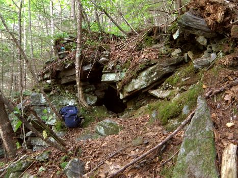
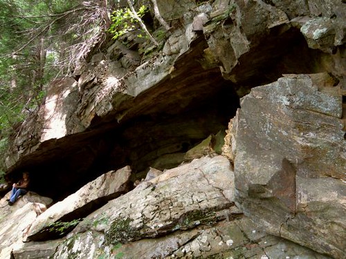
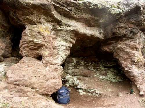
cave near Pulpit Rock, Berkshire County

Cave formation near Pulpit Rock


Continuing to build upon the past, both the recent and far, descent was made upon a section of central Berkshire County once known as the Sikes District. The name (like many old geographic features) is taken from the surname of a family once common to the area. The prominent geologic feature of the area is Pulpit Rock (yet another) and a visit was made earlier this year to meet with the owners and discuss the past in regards to their own farmland. Another feature somewhere in the area is quarry from which stone was used to build a couple local churches.

On this trip an old comrade from past excursions, Mr. Tom Hoffman of Washington, joined in for the hike up the old mountain road and on in to Pulpit Rock. A large ravine near this rock contains several small caves and probably exhibits enough characteristics to be classed as what speleologist call pseudo-karst. The area as a whole is part of the Dalton Formation with feldspathic quartzite (at Pulpit Rock) and a more schistose variety at the nearby ravine and caves.

After a thorough look at caves and pulpit, a hike was made out in the direction of the old mountain road following the general topography that drains into the cave ravine. This brought us out to the woods road at a elevation higher than where the bushwhack in to Pulpit Rock began. This area was once where the Sikes (later: Sykes) families once settled. The local mountain once bore the name "Rock Mountain" and even Herman Melville spent a year during his teens teaching at the Sikes District School.

Starting our descent, we were greeted by a carefully constructed drainage channel under the road hand crafted from native rock. Farther into the woods lay a modest size quarry probably a source of rock used for projects in the immediate area. Several hundred feet farther down the mountainside, a brief stop at Sikes Cave - a talus cave - then a return to our car already contemplating our next adventure into the old Sikes District.

Wednesday, October 14, 2009

Onward to Essex!


The Great Frog Boulder - circa 1900


With October comes the annual trek on up into Essex County. With a bountiful list of sites and topics to cover, I headed on up by starting off with my usual route - the Mohawk Trail.

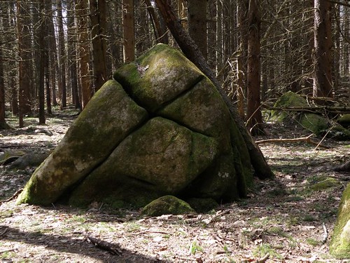
At least every other year (lately: every year) I put some time into Lynn and surrounding towns, this day taking me back to the great urban park Lynn Woods. Some years back I first visited the Great Frog Boulder (once known as the Great Dwarf Rock) but never took in the perspective of a frog. A different day and a different angle brought out the (somewhat) crude resemblance to a frog crouching. Even more astounding was the circumference of this great boulder at almost 120 feet making it amongst the most 'worthy' in Massachusetts. It might be worth mentioning at this point that large glacial erratics (indeed: erratics in general) are quite common to this part of the State.

After finishing up at the Frog I moved on to the Wolf Pits, ancient relics from the past. These are a couple stone lined pits whose purpose (as the name suggests) were to capture wolves during the colonial era. Some pipe remains from years past when it was there to protect the more modern day explorer from falling in.

South Peabody was my next destination where I was surprised to find in recent years that a thriving quarrying operation had once operated. Indeed, this whole area was explored by the Essex Institute around the middle of the nineteenth century where various rocks and caves are listed amongst their writings. I did find a few old quarry sites but the usual case prevailed where urban sprawl has mostly taken over the area. Most interesting was a piece of conservation land that survived. Within its boundaries were a huge mass of glacial boulders including one gigantic rock of the perched/'balanced' type.

Further up the coast, on one of the many beaches, I had wanted to look into the site of an old postcard called the Sentinel. However, after much driving around the neighborhood, I never did come up with access to the beach. Later that night, a Gloucester source was able to fill me in and a future visit will follow.

Finally arriving in Gloucester, where I was to stay the next three nights, I took in Mount Ann. Having read about this mountain for many years, it was great to finally see it in person. It is topped by several somewhat flat rocky outcrops. Erratics abound including one ancient inscription: 1896. Two other huge boulders were also seen off in the woods on both the journey in - and out.

Day Two: This day was planned to meet up with a renown local authority on historical sites in Newbury: Dick C. I decided to incorporate a couple of visits while winding my way northwesterly and the first stop was Ipswich.

Ipswich has the most 'celebrated' example of Devil's footprints in Massachusetts. Along with that comes the story of preacher George Whitefield throwing the Devil off the nearby church after a struggle thus explaining the origin of the footprint. The print featured is marked within a painted circle and is a shallow incised marking. I have always thought (certainly individual opinions will vary) this to one the weakest examples of these features as it only very vaguely resembles a human print. There are also those that look to be cloven hoof prints. A pretty good search of the rocky outcrop did bring up lesser foot-like formations but the real treasure was finding a good example from the cloven hoof variety.

Moving on up to Rowley I got a look at one of the many rocks used by the aforementioned George Whitefield for a sermon. This Pulpit Rock is a long ledgy outcrop pressed into service when the former church adjacent to the site could not hold the throng of individuals showing up to hear Whitefield preach.

Before leaving town I looked into what I expected to be the former site of Sunset Rock. I was under the impression it had been destroyed for the remaking of a local road intersection. Further investigation revealed what really happened was the rock got developed - built on - so now it is closed off to public access.


Haystack Boulder

Haystack Boulder


On up into Newbury I dropped in once again on Haystack Boulder and one simply called "near Haystack Boulder". Both these large erratics were feature in an early 1900's geologic treatise on Essex County by John Henry Sears. Later on I did confirm with my local expert one known as the Ordway Boulder is also supposed to exist in this area.

The purpose of meeting Dick was to focus on two sites I had no luck in definitely identifying on two previous visits to the area. First up was Gerrish Rock which I imagined to be one of several large glacial boulders lying near a local river. How wrong I was! Reaching river's edge just prior to low tide, Dick pointed out the very top of a rock just starting to show itself above water. As we watched for the next fifteen minutes more and more of Gerrish Rock would slowly emerge. Changing positions on the river's shoreline we were able to see a large portion of the rock would remain just under water. Perhaps a lower low tide might bring it forth.

Dick and I then relocated our cars a bit where we had to tramp over hill and through marshes to see the local Balance Rock. Of course it would not be much of a rock without a story! This one has pirate treasure buried nearby and the rock marked with a letter - or arrow of sorts - that was to help relocate that treasure. Upon finishing our day's adventure, Dick was most generous and helpful in providing additional information to pursue other sites in the future.

I awoke to the rains coming down but an optimistic weather forecast had the rains moving out possibly in the early. So treating myself to breakfast at the local Friendly's, I poured over maps and my itinerary to see what might be accomplished even during a moderated rainfall. One self proclaimed "Old Hippie" (and my local expert on a number of topics including the aforementioned Mount Ann) had peaked my curiosity during a social meeting the previous evening. Asking me how much I had seen of the local quarrying operations I had to confess very little. Although most think fish when Gloucester comes to mind, right in there (and first on my list!) is rocks - as in a once thriving quarrying industry. So setting off north, up the western side of Cape Ann, I motored but first making a stop in the Goose Cove area.

Day Three: I awoke to the rains coming down but an optimistic weather forecast had the rains moving out possibly in the early. So treating myself to breakfast at the local Friendly's, I poured over maps and my itinerary to see what might be accomplished even during a moderated rainfall. One self proclaimed "Old Hippie" (and my local expert on a number of topics including the aforementioned Mount Ann) had peaked my curiosity during a social meeting the previous evening. Asking me how much I had seen of the local quarrying operations I had to confess very little. Although most think fish when Gloucester comes to mind, right in there (and first on my list!) is rocks - as in a once thriving quarrying industry. So setting off north, up the western side of Cape Ann, I motored but first making a stop in the Goose Cove area.


Through a rainy lens: cellar hole marker # 26


Part of the Dogtown lore are rocks inscribed (not personally) by Roger Babson some years back. Usually what one hears are the boulders with the mottoes expressing certain morals or virtues. Also amongst the rocks can be found numbers which labeled the cellar hole locations for past families within Dogtown. Most familiar to the Dogtown traveler are those on the road leading directly from the west to old Dogtown Square. However others existed along the old Dogtown Common Road now partially submerged by Goose Cove Reservoir. I have seen one or two of these in the past but this rainy day proved very productive indeed! Near the reservoir was a rock partially hidden by the brush where long ago someone had done (what appears to be) a 'test' - or preliminary - carving. Part of the rock cut away with several roundish holes inside that area. But within the modern suburban neighborhood, some of Babson's work still remained carved on boulders in modern day front yards.

Turning once again northward and following the coast, a few of the old Lanesville quarries were visible from the road and one or two smaller ones I hike in a short distance to view. A brief stop ensued at Halibut Point where one can find a park and quarry accessible to the public. Here the trip turned southward only to stop for a brief glimpse of the Cathedral Rock area (much explored in the past) and stopping at the Granite Pier to give a token look at the coastline for Profile Rock, Devil's Den, and Rockport's Oldest Inhabitant (profile formation) which I've done on several past occasions without success. In this area is a keystone bridge but leading to other old quarries now off limits as part of Rockport's water supply.

Coming down the coast just as low tide was arriving, I made visits to Long Beach to match rocks from an old postcard and Good Harbor Beach where the Viking's Daughter, another profile formation, once resided. Either it no longer exists or has been hidden away by change as I did not observe her. This particular low tide was far enough out for me to get a good view on a certain section of Bass Rocks I have not been able to observe in the past. Exposed for my eyes were an "Old Man" and a minor cave formation. Farther down the coast, an old favorite in the George Washington profile and a confirmation on the site from an old postcard: Money Rock.


Rayne Adams boulder


As I was chowing down my favorite local pizza (now mid afternoon) the rain mostly stopped and even a bit of blue sky and sun began to come out. Deciding to 'go for it' I headed off for my traditional Dogtown hike trying to incorporate some previously unseen areas and some old favorites. So going north from the Dogtown Road I eventually ended up quite near to earlier in the day by Goose Cove Reservoir. I hoped to find more cellar hole markers on the other side of the reservoir but on this trek only one, along with the Rayne Adams boulder, was seen. Eventually swinging south by Abram Wharf's old homestead and Granny Day's Swamp, I arrived in Dogtown Square. Near here I revisited the motto "If work stops values decay" and tried to match the Pearce cellar hole #23 (rock seems to be missing) to an old postcard of the same. As the day was waning, I headed back out and visited the "Never try never win" and Jas Merry rocks where one marks the 'first attack' by a bull and another nearby where he died.

Day Four: Before leaving Cape Ann, one more stop was in order: Red Rocks. This is the local name for a section of Harvey Mountain, diagonally across Rt. 128 from Mount Ann, and once all considered part of Thompson Mountain. This is the favorite local area for rock climbing and well deserved. I climbed to the summit area after passing one giant perched erratic (circumference in excess of 60 feet) and an obvious ledge used by climbers. The summit afforded a worthwhile view all the way to the ocean along with numerous erratics and, if one were to use a bit of imagination, some of those old 'footprint' formations. Rounding the summit and coming off the opposite side, I got to view an even more spectacular set of climbing ledges than passed on the way in.


Boulder along the Bay Circuit Path

Boulder along the Bay Circuit Path


Turning my attention more westward, Cape Ann was finally left behind in favor of Andover. Here, it was decided, to seek out three different conservation properties before making the trip home. What was taken in between those properties included a former Native American soapstone quarry, giant erratic, Bay Circuit Trail, Sunset Rock, and Indian Ridge - a large esker.

Sunday, October 4, 2009

With the coming of October I am now compelled to focus on a handful of goals to finish out the season. Most known I usually take the winter to 'hibernate'. Since late winter of earlier this year, I've had a map. A map listing some rather interesting geologic (and historic) sites out amongst the tract once known as Brookfield. In the early history of Massachusetts this was a huge piece of territory and the westernmost settlement after the coastal areas. Now - like so many of the lands - it has been subdivided into a number of towns.

But with my list and map along I set out to work a couple of the sites with some ledges up first. Somewhere in the vicinity of these ledges was a Native American rock shelter/cave, home to the last of their kind in town.

The ledges were found without significant trouble although the exploration was a bit difficult moving along their mid section with cliffs above me and broken talus bordered by a bog below. When finished I made my way through a chimney to the top where I was rewarded with some spectacular 180 degree views. Noticing the map listed "Cat Rocks" nearby, I hiked on over to find some smaller ledges, probably the kind that long ago were the abode to wildcats.

At this point the trip began to take somewhat of a turn. I hiked back across the top of the high ledges as the map listed the Indian cave to the north of these. Upon arriving in the area I saw a complete lack of any rock exposures and what few words with the map could be interpreted as the cave was down at the ledges. So I revisited the base of the ledges to find a fair sized talus cave and was somewhat (but not entirely) content this might be the site.


Rock House; early 1900's postcard

The Rock House - early 1900's postcard


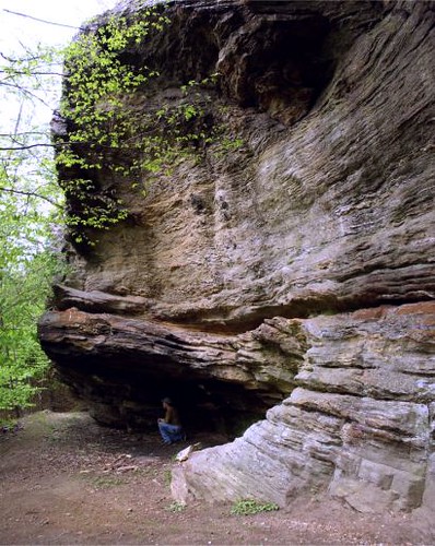
It was decided to leave the rest of the map - and list - for future explorations and take the scenic route back to western Massachusetts. This allowed me to stop in at the Rock House Reservation in West Brookfield which has a huge, bona fide Indian rock shelter.
Upon the return home, further research revealed the Indian cave originally sought was not at the ledges and the map was somewhat in error. Additionally some of the information (including place names) were ambiguous. So next time - the Cave!
Saturday, September 26, 2009


Devil's Pulpit (upper left) and associated cave - right; Connecticut River Valley

Devil's Pulpit and Cave


The goals on this trip were to find another access point, and to do a bit of good old reconnaissance. The site was once again the marvelous rock features within the Connecticut River Valley and was once known during the 1800's as a natural 'park'. Although I now have dozens of trips behind me when it comes to this area, its uniqueness cannot be understated. No where else in Massachusetts is so much incorporated into one area.

With that said, entrance to this section of the former 'park' was made by way of Mitchell Hill. This is one of many archaic names now long forgotten by both the modern generation and even the local residents. Making my way up the remains of a past mountain road, that once saw many a horse and carriage, I found suitable parking.

When the area was written about some 140 years earlier, the writer was very eloquent in painting the landscape with many a quaint term. One such description used was 'shelves' to describe the many ledges of rocks one encounters while ascending and roaming about the mountainside. Indeed these shelves diverge, converge, and disappear altogether.

My ascent was made steeply on a slope, stumbling upon the small pieces of arkose and conglomerate. On reaching my first plateau backed by a conglomerate 'shelf', it was time for the exploration to begin. Back and forth - weaving from one level to another - I finally stumbled into a 'devil's pulpit' formation with a cave! This shelf yielded many more interesting formations before merging into the main ledge once know as "The Home of the Rocks".

Right about at this point is the glorious Grand Porch, a sort of gigantic open faced shelter that is open on one side with its disintegrated remains forming small talus caves. By retreating along the direction I took, but upon a higher shelf, I took in a number of bear's dens and the area once called Titan's Pasture, a passing remembrance to the ancient Gods of past civilizations. It is not the only such recognition as we also have archaic references to Titan's Quarry, and the Titan's Dooryard.

But at Titan's Pasture is an interesting cave, hidden up in the ledges, with entrance gained only by climbing. This cave is another in a series formed in a manner described by speleologists as gravity slide or gravity assisted. Obviously the action of frost (hence: frost action) plays a part in 'quarrying' these large masses of rock from their parent ledge. But within this cave I was pleasantly surprised to see a bat. A healthy bat no less, free from the dreaded White Nose Syndrome (WNS) that has been ravaging their kind. Fecal matter indicates possibly more than one might use this as their hibernaculum.

Upon the exiting of Cave at Titan's Pasture, a methodical retreat was made down the mountainside checking shelf after shelf to more or less tie the exploration - past and present - all together.

Wednesday, September 16, 2009

That time of the year again - the South Shore adventure and a chance to work most of the Plymouth - and some of the Norfolk county areas.


Traditional site of John Eliot's Pulpit Rock

Day One approach by good old Rt.s 95/128 swinging around the outside of Boston. Landing in West Roxbury ('home' to the state rock: Roxbury Conglomerate) I proceeded to look into a couple of cave formations within. One is the traditional site of John Eliot's pulpit, an early preacher to Native Americans. The second site - like the first - was a split rock formation where the pieces of rock form a crude shelter. So far in my investigations, this is the typical 'cave' in these parts - and these rocks. However, also found in this area a few years back, a small shelter worn out from under a ledge. I believe occasionally used by the homeless.

Before leaving town I took a quick spin through a neighboring town where an early 1900's history mentions a former cave. All built up now, I can only image what might have existed within the area where a few outcrops of puddingstone can still be seen.

Arriving in the glorious Blue Hills, I continued on with a search begun in June of last year. A small, shallow cave by the name of Rattlesnake Den was written about in the very last years of the 1800's. I've theorized where the general area may have been and mapped out a section to investigate. Some fine hiking but no den so I'll give it a go at another time.

A couple of quick sites before setting up camp. To the south of the Blue Hills, a large perched glacial erratic. This was brought to my attention by a reader some years ago around the time I was looking for Squaw Rock in the same town. It may be this rock as one local resident thought, but again it may not. Finishing the day as I swung out towards the shoreline areas was conservation land which brings one within sighting of the Glad Tidings Rock with a couple of legends as to how it got its name.

Day Two began with a early morning walk at the Worlds End property in Hingham. A beautiful piece of property and a section called Rocky Neck which will be worth another visit in the future.

Retiring to a local library, I put in some quality research time before heading down the coast. One of the towns has a history replete with 'devilish' formations, Indian ovens, and a pulpit Rock. I have made several visits over the years always coming away empty handed. But persistence can sometimes pay off and with information gathered on a library visit last year I located their very own Pulpit Rock and a likely possibility for a Devil's Rock with His footprints. Hopefully much more to come out of this town in the future.

Landing back at camp to clean up and eat, I did some light duty by visiting the former site of Great Rock (destroyed) and Turkey Hill: hilltop farm land with views now under the protection of the Trustees of the Reservations. One more library then back to camp for the night.


Pulpit Rock

Day Three: Starting the day out in northern Plymouth County (in the same town where the county's largest glacial erratic lies) I went out to look into the story of a "Devil's Cave" near a major river passing through the area. An old abandoned railroad line provided the access and the 'cave' turned out to be a split rock formation. Other features in the area were Indian campsites, old dams and a factory, as well as a herring run.

Farther south in the land of Bridgewater, I revisited Sachems Rock although my main purpose was to renew an old acquaintance from the immediate area. Apparently they have disappeared but Sachem's, marking an ancient land boundary, still remains. Then on to Minister's Rock with its quaint inscription and a nearby Pulpit Rock.

Slipping briefly over into Bristol County, I connected with the local library to deliver a photo and information on their very own Devil's Footprint. Then on out of town (just barely) to hit another 'cave' attributed to old King Philip. This one is formed by the overlapping of some huge boulders near a hilltop.


Indian/King Philip's Cave

Day Four: The original intention of the South Shore trip some years back was to devote time mostly to the towns of Cohasset, Hingham, Scituate, and even Weymouth. I really had not spent much time in these towns on this trip so as a parting gesture I hiked on in to Wheelwright Park. The park is home to Big and Small Tippling Rock as well as the Devil's Chair. Big Tippling is indeed a worthy boulder at 55 feet in circumference. But its dimensions do diminish a bit underneath as well as on top.

On over to the big event of the day: to meet up with members of a local historical society. The purpose here was to continue on with the search into "Writing Rock". Between the coffee, the crumb cake, and conversation with a number of very learned, very gracious members, much more was gained that information on just one rock. Apparently the rock had symbols matching some on the more famous Dighton Rock and has also been made off with! It's exact location is somewhat unknown.

Before turning the car homeward a brief hike was made into a neighboring town's Town Forest. This also was a continuation of a search started last year for another Devil's Den. It is somewhat conjecture that this devilish den lays in the area (also home to the Garden of the Gods visited last year) but it also may not. Nearby is a section of land known as Rocky Woods and, in the future, I may move my search more towards that direction.

Saturday, September 12, 2009


Insurgence entrance to Great Radium Springs Cave; Berkshire Co

One of the entrances to Great Radium Springs Cave

A regional group of cavers descended upon the central Berkshires for the weekend. I stopped in to say "hello" to the few I might know from ages ago. On the immediate premises was Great Radium Springs Cave which was confirmed as the longest cave in Massachusetts some time ago when two intrepid cavers went through a watery sump connecting sections that were previously visited only through two different entrances. Radium Springs was a nearby spring that produced bottled water and soda during the early parts of the 1900's

Monday, September 7, 2009


The Natural Ice-House/Ice Cave; Franklin Co

The Natural Ice House/Ice Cave


Seems like Fall is beginning to make its way into the Northeast. Some dread it for no other reason than they hate what's behind it - Winter. Personally, it is with out a doubt my favorite time and begins a race to see how much I can get in before Old Man Winter closes my season out.

My objective on this day was a leisurely trip over to the 'far' side of the Quabbin Reservoir. Here in the former Town of Dana (modern day Petersham) I walked beautiful old roads lined by stone walls on my way to a remote hilltop to look over glacial erratics. Many of modest size were present with a good number 'split' by the forces of Nature. One in particular was most interesting as a tree had taken root and grown up by the side of a section of split-off boulder. Upon reaching the top surface of the rock, grew horizontally on the rocky surface before deciding o once more push upward vertically.

There were many stone walls running perpendicular to the main wall of the road that once sectioned off individually pieces of property. Almost no signs of previous habitation could be seen within those boundaries. But in one case a curious stone lined underground chamber did exist.

Upon exiting these woods I drove a short distance further on over to Franklin County. Still much with the realm of Quabbin, I dropped in on the popular Bear's Den, home to a former grist mill, legends of King Philip, and abode to the bears. Although best know for its picturesque falls on the Middle Branch Swift River, it is also home to some interesting speleology. Small caves have developed during the process of weathering out of small sections of the cliffs. Basically two very small caves are able to handle a human but many other "quasi cave" formations show the same forces that created those, are still at working creating future caves.

Returning north to the Mohawk Trail, I visited an access point set up by climbers to visit impressive ledges that also contain fine caves I've examined in past years.

Lastly, I busted the woods through damaged trees and broken rock upheavals to try to relocate the Ice Cave, less than four miles south of the New Hampshire border. Although a previous GPS reading (a device I have mixed feelings for) sent me on a bit of a wild goose chase, eventually it was found. Not much to this 'cave' although local history writes of it as a natural ice house. And cool it was!

Monday, August 31, 2009

It is with a certain amount of regret I must realize that many of my projects continue to fall by the way. Living way out in the western part of the Bay State does not make 'do-able' (most of the time) travel to eastern parts and down into Rhode Island. But with that said, I am in a good position to continue on working the Connecticut River Valley. So on a day that seems to herald the oncoming of Fall - I returned.

So on I continued with my deliberate and systematic search of ledges within the Valley mountains. Picking out a section that on the topographical map looked promising, I parked and headed out into the woods. Once again I hoped that I might come across the long lost "Warner's Ledge" photographed some one-hundred and forty years earlier.

With time, things (of course) have changed and access to the mountains is often blocked by nice spiffy newer homes. But finding a rare piece of property not built upon, I made my way into a series of conglomerate ledges that yielded but a couple of very small cave formations. I zigzagged on up in elevation until I stumbled on in to an old 'friend' in the form of Graves' Ledge or the Rock Shelter.

I always can find something new - or check some of the old photography done here - so I decided to proceed down the entire length passing all the favorites at Castle End, Etta's Nook, Rock Roof, etc., etc. and finally pulled up at Willard's Point. Consulting with my stash of antique photography, I realized I had not done a good job previously in matching my modern day photographs to the older one. Careful analysis, and correct positioning of the camera tripod, brought me a much better representation although the Point itself is now somewhat obscured by the trees.

Adjacent to Willard's are the Twin Slabs which really are a section of the conglomerate ledges that have tumbled forth and landed upon their sides. And just beyond this, the always impressive Rock Rift. I mulled over the possibility of a photo shoot but with heavy tree cover found it not worth the effort at this point in time.

It was at this point I decided to do Graves' the whole length. Something I had not done since I originally stumbled on into it some five years ago. So the next Victorian Age feature in the photographic series was Fortress Rock. This section of ledge is a mighty monolith of stone separating into two levels just beyond the Rock Rift and running for a couple hundred yards only to come together again near the site that the old photograph depicts.


Annie's Retreat in the Connecticut River Valley

Annie's Retreat

Upon leaving the 'Fortress' the massive ledges continue on a bit farther with Annie's Retreat being the last in the photographic series on these set of rocks. Annie's is a comfortable cave formation in the base of the rocks and would be the ideal picnic spot in The Victorian Age or even today. From here I followed on out what rock ledges were left. Then down from the mountain to the highway and back to the car.

Friday, August 28, 2009

Shadows of Ashintully


Tytus' Den; Berkshire County

Tytus' Den

My next visit took me to the region of southern Berkshire County. Back in the earliest years of the 1900's, Robb de Peyster Tytus assembled the Ashintully estate from several farms in the valley of Tyringham. Dying at an all too young of an age, he, his wife Grace, and one of their children, are buried on a local mountain top.

The mountain also boasts magnificent forests, a picturesque stream, and a cave of sorts weathered out from the ledges of yon mountain.

Monday, August 17, 2009

Route 7 is an old historic highway I've traveled much in past years. Not so much in recent time. It winds up past some of the best karsts in the northern half of Berkshire County. But on this particularly brutal hot summer day my destination was Massachusetts' most northwestern community: Williamstown. After hearing of Stone Hill for a number of years (and its associated geologic feature: Stone Hill Slice) I decided the time had come to investigate it. I also had two postcard images of an early 1900's couple at the "White Rock" and thought it might be worth a look for this feature also.

I made my way up the old road that is said was once the original road into southern Williamstown village. Deep into the woods I began to see the long, massive wall of quartz that made up the western face of Stone Hill's summit. Just beyond this was a stone seat constructed as a memorial to Williams College professor George Wahl. A bit farther to the north is a curious boulder lying in a small grove of trees. It appears at first glance to be a blue-gray rock - probably marble - interspersed with significant quantities of white quartz. On the return to my car, I gave the quartzite cliffs, and immediate summit area, a cursory exam saving the harder work for a much cooler day. So although the location for the "White Rock" postcards was not found, I already am working another idea of its locale.


A geologic cave entrance but not physically enterable
at Carmelite Caverns


A short drive to the nearby Carmelite Caverns (not visited in many a year) provided a previously unseen view into the cave's speleology. Here we have the rough boundary between the e and d marble units of the Stockbridge Formation. Interesting to note that this same bedrock alignment exist at a small series of caves about a mile to the south and at the Mc Master's Caves perhaps a third of a mile beyond those.

Wednesday, August 12, 2009

Anatomy of a Profile


Let us take a brief respite from the heat, humidity, and bugs to travel back into times past.

Long ago on a (still) well visited beach along Buzzards Bay lay an attraction know as the Profile Rock. It never looked liked anything to me, both from a personal appearance and all the postcard images floating around the internet and at old shows. One old postcard even had the audacity to put in writing on its reverse side; "At certain times of the tide and with the sun in certain positions there are many remarkable profiles discerned on this rock." I was still not impressed as the 'best' I saw was a 'beaky', buzzard-like appearance.


Profile Rock @ Buzzards Bay: 1890's


But long ago during the 1890's some enlightened soul decided to produce an image of said profile. Now we're getting somewhere! A rough outline of a human face could finally be seen. As for all the old postcards (of which many exist) if it showed that side of the rock, yeah, maybe we could see that profile.


Profile Rock

Profile Rock @ Buzzards Bay: early 1900's


But time marches on and the modern age brought in beach improvements. With sand and a shoreline farther out, the profile of Profile Rock became largely buried - and forgotten. Forgotten? Well, not completely as long as there are those that thirst for history past. As for this author - my next trip to the profile rock will include a shovel.


Profile Rock

Profile Rock @ Buzzards Bay: 2003

Sunday, August 2, 2009


Water wheel at Terryville, CT

That time again - for a visit to Connecticut. By nature this is more for rest and recreation but the shadow of history - and even geology - is not far off.

First stop was in Farmington at the Hill-Stead Museum. Here, magnificently preserved, is a home harkening back to the golden age of opulence during the late 1880's. Within its walls are an art museum from the collecting of the original owner who was one of the early enthusiasts for Impressionist paintings. Much stone was worked into the exterior of the home, including it's pasture walls and gardens, and yes - the grounds once had its very own quarry. Also on the grounds (after a quick trip to the local model airplane airfield) is a modest set of hiking trails that lead through forests, swamps, old apple orchards, and one can even join up with the Metacomet Trail running through the neighborhood.

Connecticut history also boasts a series of canals. One of these once ran through the Southington area where part of an old railroad line has been turned into one of modern age's popular bike trails. Upon reaching its end, the old route continues off through over grown fields with the remains of an old bridge across the Quinnipiac River.

The second day was devoted to visiting a pretty nice park in Bristol - Rockwell Park. Lots of old stone work, a spring, ponds (one now non existent), and a system of hiking trails. Afterwards was an environmental park with its own trails winding through bogs and woodland. Finally, with light rain falling: the old water wheel in Terryville, presently under renovation as park of a public park.

Sunday, July 19, 2009


The Devil's Washboard

Devil's Washboard


Over the previous winter it was decided to spend time in and around northern Franklin County to mostly revisit old sites for the purpose of furthering my knowledge on the area. Continuing on with this I ended up in the most northeastern section of that County. It is mostly covered by the old Mt. Grace geologic quadrangle, first Massachusetts bedrock geologic map in the USGS GQ series. This "quad", and adjacent areas to its immediate west, cover a wide spectrum of interesting features. Among these are a few caves, a tipping rock, a Wabeek boulder, a chamber, old iron ore and potash mining sites, Indian Kettles, and - my first stop - the Devil's Washboard.

The Washboard is now accessible thanks to the Mount Grace Land Conservation Trust . On the hike in, a small miniature chasm carved in the streambed could be observed just off the trail above the crossing of the brook and wetlands. Eventually this trail ends above Devil's Washboard and it's up to the hiker to pick his way down to stream side. However, one is rewarded with a wonderful waterfall dropping its way down through a natural basin. The whole area, especially upstream, is a picturesque chasm with rock walls. Also just upstream is a 'grotto' or schistose den eroded away in the ledges.

Some years ago I visited the Indian Kettles and thought I'd give it a go at accessing them from a different direction. Although unsuccessful, some of my best finds come almost by accident. I passed by a couple old cellar holes still in fine condition. One has interior partitions (some have called 'chambers') and I've been told it was an old tavern. Beyond was a marvelous set of waterfalls heretofore unknown to myself.

Monday, July 6, 2009

Origins Part II


It was probably early on in the second half of the 1990's while working on the beginnings of a Statewide cave project things took a significant turn for me. While searching though the histories of local towns, I found how significant a part the geography - and geology - played in their past. Later on I discovered how some of these sites had captured the attention of even the scientific community as a search through old science journals will turn up reports well back into the early 1800's. In particular glacial boulders - often listed as "rocking stones" - were amongst these.


Hiram's Tomb - circa late 1800's

Hiram's Tomb - circa late 1800's


Visiting one old favorite of mine, situated in the northwest corner of Hampden County, is Hiram's Tomb. Hiram Smith had a fear of being buried beneath the earth so he had a large boulder, high on a ridge, hollowed out where he and his sister could be interred. Of equal interest is what happened to money left for the upkeep of the land accessing the tomb. It was taken by the individual it had been entrusted to and the tomb now sits in a forest, grown up to surround it.

From Hiram's Tomb I moved on to the former village of Knightville and the dam that has taken it's name from that village. Old postcards depict the gigantic Leaning Rock (aka: Devil's Elbow) laying alongside the bank of the Westfield River. On this day it was well engulfed in foliage and the river running wild with all the recent rains.


'Classic view' of the old rock - as pictured in old area histories; Hampshire County

'Classic view' of Tipping Rock


On into an adjacent town to investigate the R. O. Den where nature has worked Her magic by quarrying away rock out of a ledge to form a small cave. Also in this town the local Tipping Rock which received some notoriety back in the 1800's. This erratic - not large at 38 feet in circumference - lays back in the woods along an old road that once led to a mountain top with a "government survey station". Apparently this station has long disappeared from the face of the Earth.

The road home brought me by Anvil Rock. A somewhat unusual natural roadside ornament lying out in a local resident's front lawn.

Sunday, June 28, 2009

On an August day in 1853, at a small knoll in Stockbridge, Massachusetts known as Laurel Hill, the Laurel Hill Association was born. Laurel Hill is formed as part of the Dalton Formation, comprised primarily of metaquartzites. The same bedrock unit stretches out to the south where less than a half mile away lies the well known Ice (or Icy) Glen. To the north and east lie namesake units of Stockbridge Marble along with a smattering of marble units within the Walloomsac Schist.

But Laurel Hill has its own stone seat and rostrum (pulpit) and a short, steep hike to its top brings one to a partial view and another magnificent stone seat.


One of the small caves at Bartholomew's Cobble


Down at Bartholomew's Cobble in Sheffield I was warned how ferocious the mosquitoes had become. It was an understatement. The trails were wet - the adjacent Housatonic River full. Several minor caves are located here along with flora unique to the marble/limestone bedrock.

None of these caves appear to be formed by solution although small solution features are present. What is very conspicuous is quartz and indeed a latter check of geologic data reveals this to be a quartz unit within the Stockbridge Marbles.

From the desk of the armchair traveler (how's that for an oxymoron?) an answer to what in heck is the profile at Profile Rock on Buzzards Bay. This was one example that just didn't "cut it". However, a 1892 news article surfaced in cyberspace accenting the profile. The bad news is this rock has been partially buried by sand on a public beach and the section with the facial feature is now covered!

Sunday, June 21, 2009

Origins


Father Stan

Father Stan (L) poses at a central Berkshire cave entrance


Oh well - a somewhat belated summer has finally arrived. Heat, humidity, bugs - although the ticks have been roaming about since late winter and are now biting in monstrous proportions. A somewhat strange weather pattern persists that does not give many days a break from some sort of rain.

However around this time of year many, MANY years ago it all began for me. I remember being in the midst of collecting comic books which have become quite the collectible in more recent decades. Issues placing the origin of certain characters ranking high as a collectible. So for the occasional traveler through this site (personal acquaintances know my story well) here is my "origin".

Obviously it begins with parents but beyond the biology was a Father. Stan was a well know cave explorer out of western Massachusetts. A learner to Clay Perry famous for his books on caves in New England and New York. Being the youngest of four children (all sons) I had patiently waited for my own turn to visit the stygian underworld I'd heard so much about.

It all began just to our north in an old marble quarry dating back to the mid 1800's. The sense of excitement at approaching the quarry's edge, and peering down in, will always remain with me. There - a small slot provided entrance to Baker's Quarry Cave. Although I can't say I saw my future flash before me, I definitely knew something special was beginning. More than providing entrance to a natural tunnel thousands of years old, I was gaining entrance to a unique world where geology and history intersected.

Although there is much more to the tale, this makes for a fitting story of one's Father - for Father's Day. So long after his demise, Stan travels with me each and every time I head on out.

Explorer @ Baker's Quarry Cave entrance, Berkshire Co

Another generation waits her turn at the entrance to
Baker's Quarry Cave

Saturday, June 6, 2009

Indian Rock, Worcester Co

Indian Rock


On this day I ventured over to the far (eastern) side of the Quabbin Reservoir to join with the East Quabbin Land Trust. Here, they have an ongoing project to bring Indian Rock out of the woods where it has lain for probably the better part of the past three decades. A trail was begun the day of my October 2007 visit, and that trail needed maintenance work, particularly after a winter that was cruel to the area woodlands. The ridge that the rock rests upon once sported a fine view, especially eastward. It is the hope of the EQLT to once again make that view possible.

Wednesday, June 3, 2009

The Pinnacle, Norfolk Co

The Pinnacle


This adventure begins where I began my April vacation - on Massachusetts State Forest land, just above the Rhode Island border. Taking on a different section of the Forest from where Boulder Cave lay, I returned to two small but interesting cave formations. The first would barely be human sized but has a smooth, worn passage somewhat reminiscent of a solution cave but likely is not its origin. Right nearby is 'another' boulder cave (this whole area of State Forest land is replete with glacial erratics)but with a definite 'passage' underneath. Here we have a huge boulder with just the right dimensions, setting down on a ledge, providing the small cave underneath. Also nearby is, what I have named, the Pinnacle, a giant spear of rock standing straight up at least 20 feet high. A casual look seems that a large, somewhat flat, erratic was left standing on what was previously its side. After clearing out of State Forest property, I took one more look for the cave formation in town that I failed to find back in April. This time it was a success and it lay amongst the red and purplish rocks indicative of (what is now mapped as)the Blackstone Group in these parts.

Working my way south adjacent to the Rhode island Border, I visited a splendid balanced erratic and 'boulder den' (cave-like formation) within a local park. More of the reddish rock was present on the face of the Den (it might be noted that a nearby area is documented for an occurence of red limestone). Turning east away from Rhode Island, I cruised on into a town holding a superb example of the Devil's Footprint formation. This set of footprints comes complete with story of a local man and his pact with Satan. Finishing out my day on the other side of town was one of the several King Philip's caves scattered around Massachusetts. Heading down deep into southeast Massachusetts I found my campground closed but a quick phone call confirmed sites available at another State Forest farther down towards Buzzards Bay.

Minister's Rock, Plymouth Co

Minister's Rock: early 1900's


Sliding Rock, Bristol Co

Sliding Rock: early 1900's


Day Two was to be primarily coastal towns starting in the western Buzzards Bay region and heading west from there. My first stop: Minister's (occasionally: Pulpit) Rock. Also seen in town: a split rock formation that made at least several appearances on early era postcards. I had been told by the landowner on a previous visit, Calvin Coolidge and Warren Harding posed by this boulder for a photograph long ago. In the next town west I drove by a giant pair of rocks visited on a previous trip know variously as Great Rock, Split Rock, and even Big Rocks but my investigation took me nearby to another reported "Great Rock". Located on a local golf course, I was graciously granted a tour of the surroundings, including the rock which they call Split Rock - yes, another! Afterwards, a direct line was made south to the coast in search of the Sentinel, a rock sitting off the shoreline portrayed on another old postcard. One more town west and a look for two features mentioned in local history writings: Leanto Rock and a Devil's Footprint. A thorough search revealed nothing definitive on these reported ahoreline area features. It is not usual for seaside rocks to have shallow, cup-like depressions and to say one is the footprint without further knowledge would be impossible.

I decided to bypass a few things on my list and continue directly west to Fall River where Sliding Rock lay waiting in a local park. While in town, a long overdue return to the famed Rolling Rock (one historical reference: Goose-nesting Rock) which is now the "official glacial rock" for the State of Massachusetts. Just outside of town, I stopped to visit an old friend/eBay dealer and great source of information on the local area. Nearby: an alternate access route was scouted to another King Philip's cave. On the way back to camp, I did a drive by check for a route to Joe's Rock and finished the day at the local library.


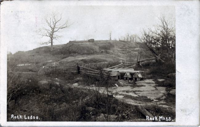
The rock ledge from which Rock, MA takes its name.

Early 1900's postcard


On a somewhat abbreviated third day, I journeyed up the Rt 495 corridor to investigate the origins of the Town of Rock (got to love that name). Along the way, a trail was discovered on land trust property that covers roughly the area that lends the Town its name. An old quarry site (and modest example of a 'footprint' formation) were present. I believe the location was found for a couple old postcards but will have to work this a bit more for further confirmation. I finished the morning, before heading home, in a neighboring town looking for a couple Indian ovens (rock formations) but a lack of definitive information made them impossible to locate. However, I did leave town with knowledge of possible contacts that may help. Location information can often be a long process.

Monday, May 25, 2009

Table Rock, Connecticut River Valley

Table Rock: circa 1870


On this excursion into the Connecticut River Valley the goals were more hiking and historic rather than geologic, although the latter is most always inescapably tied in to all I do. Making my way up the old mountain road, I set off to search for Paradise and the Garden of Eden. These names were very much tied to a section of mountain terrain and already in use by the late 1860's where I came across the first written reference. My journey took me over old Kellogg Hill (another archaic name) to one of the Valley's finest vistas - or "prospect" as they use to say. At one site I passed at least a half dozen conglomerate erratics - not native to this immediate area - strewn about as if it were the playground of the Gods - perhaps the Titans. One boulder carried the weight of two trees growing upon its top surface. This whole are is set back above a magnificent escarpment with Paradise - and its beautiful ravine - being it's northern boundary. Finally turning back - and upward - I climbed up into a commanding length of conglomerate ledge where one Giant's face of stone peered down upon me. Making my way the mountainside to my car I regrouped to head into the Garden of Eden. Also setback from a lengthy escarpment the old site likely existed with in cirque - or corrie - several of which exist in this area carved out by the glaciers of long ago. Eventually I passed an outlook with an old survey station marker and reached a spring fed swamp located within the top portion of a double cirque. The outlet for this marvel of nature is a stream that leaps over the escarpment forming a superb cascade. On the return to my car, I did some checking into the walls of the cirques where a partially buried stone wall spoke of times long ago forgotten. The way home - I took the lazy man's approach to Sugarloaf whose road is now open for the season. King Philip's Seat/Lookout, or Table/Jutting Rock as it is sometimes know, has been fenced off for years and views of it mostly hidden by foliage.

Sunday, May 17, 2009

Pulpit Rock, Berkshire Co

Underneath Pulpit Rock

Some of my very best times do not involve a rock - or a cave - or even being outdoors. On one marginal weather day I had the pleasure of meeting the family at a local farm in the central Berkshires to talk over the history of (one of many) Pulpit Rock. Although it never was ascertained if this rock was preached from by a real clergyman, the conversation went on to talk of many sites and bits of history throughout western Massachusetts. Nearby is a (previously unknown) quarry that provided stone to the building of two local churches. I will revisit Pulpit Rock and its caves at a future date for further investigation.

On the way to, I tried my hand at photographing Tory Cave but the stream it lays upon was much too high to cross. In the process I hiked on up through what has sometimes been called Tory Glen. A beautiful example of sylvan wilderness.

Sunday, May 3, 2009

The Bear's Den, Upper Connecticut River Valley, MA

The Bear's Den


For me personally, I have two significant reminders regarding the outdoors during early May: black flies and allergies. With inclement weather rolling around New England, I set out to see just how far I could get on a somewhat gray day. Heading up north to meet with the Mohawk Trail, I then continued my journey a bit farther north ending up at Pelham Brook about 5 miles south of the border with Vermont. The Stone Face/Profile Rock was my goal and I hoped to solve its mystery once and for all. A number of visits to this area, including the local historical society, have been made and finally last Fall a likely candidate was found in a stream side boulder. The first problem (after locating it) are the two postcards depicting it are quite different. Sure, certain shapes and striations on the rock are similar, but that's about it. The rock I gave careful examination to has some similarities with the two images but not enough for me to say definitely this is it. So it seems it will have to remain the likely Stone Face/Profile Rock.

On the return to the Mohawk Trail, I quickly looked into an old copper mine then headed on east into the northern portions of the Connecticut River (or - Pioneer) Valley. Turning north once again, I ended up at the Bear's Den, this time less than a mile south of Vermont. This is an ongoing project to revisit some old sites around northern Franklin County that haven't been seen in a few years and update my information. Bear's Den is formed in argillites where the bedding plane is tipped nearly vertical. Weathering has taken out a significant mass of rock making for a large chamber in the hillside.

Working my way farther south, I ended up again in the location where I've been researching the history of local rock formations in the Connecticut River Valley region. I proceeded to investigate the new set of ledges discovered on my last visit a week and a half earlier. Some natural chimneys, along with very small gravity slide and weathered out shelter caves were found. I've been looking over ledges one by one to see if I can find a match with historical data. On this day, I looked into another nearby ledge in search for "Warner's Ledge", but once again I came up empty handed. Nearby was Etta's Nook, so with the rain beginning to fall, I wandered on in to shoot a quick set of photos for my HDR (High Dynamic Range) project. Castle End is the gateway to this set of ledges and on my way out I did photos for a panoramic picture.

Sunday, April 26, 2009

Cross Rock, Berkshire Co

Cross Rock


Balance Rock, Berkshire Co

Balance Rock


Dabbling in the area of HDR photography, I ventured out to my favorite old proving grounds at the Balance Rock State Park. Here one can find an assortment of old relics in Cross Rock, Split Rock, as well as one of the Northeast's best know perched erratics in Balance Rock. Although the jury is still out on how useful HDR may be in my own projects, it can produce some 'lush' results. In the end - it still comes down to lighting.

Friday, April 24, 2009

King Philip's Cave, Connecticut River Valley

King Philip's Cave


Continuing on once again with the Connecticut River Valley rock formations, I worked a series of precipitous sandstone ledges. Niches exist in these cliffs including one minor cave formation known locally as King Philip's Cave (King Philip also had his "chair" at Table/Jutting Rock). Hopping over to the east side of the Connecticut River, I took on conglomerate based bedrock. In this region I reexamined familiar old sites with names long ago forgotten. Some of these included Fern Cascade, the Arch the Fissure, and a possible site for Wild Cat Den. This whole area is a fascinating piece of geology with a long extended ledge which is a hanging wall of a fault. Fern Cascade leaps over this wall with the Fissure being a natural passageway between the wall and the Arch. The Arch is a massive detached section of the hanging wall that itself has separated, with its own natural passage running through it. The likely Wild Cat Den is a boulder cave formed from fallen sections of the same ledge. In another region of town, I parked at another popular cascade that also has its own archaic name in Munsell's Cascade. While hiking through the woods another splendid ledge with its own marvelous rocky formations was discovered. But being close to the end of my day - I left it for future exploration. But one quick stop was made at the spot formerly know as Stony Hill, somewhat chopped up by a latter day highway relocation. It was from this location several pieces of antique photography show beautiful views of the Connecticut River and the mountains on the far side.

Monday, April 20, 2009

King Philip Rock/Quinsnicket Cave formation, Rhode Island

King Philip Rock/ Quinsnicket Cave formation


Cobble Rock, Rhode Island; late 1800's

Cobble Rock


Vacation has once again arrived and I raced out ahead of incoming inclement weather to try and get a couple days in. Back in the late 1990's I spent a considerable amount of time in Massachusetts just to the north and east of the Rhode Island border. It is here I returned to a favorite old haunt of mine in Boulder Cave which is really a large glacial erratic with a modest overhang to it. Split-off pieces complement the "cave" experience by forming a crude exterior wall. To my surprise, a measurement of this big boy boulder came in with a girth in excess of 100 feet. Slightly closer to the Rhode Island border, I looked into a series of ledges where both conglomerates and the red slates of the Wamsutta Formation presented themselves. Much of a mystery to me was a small cave formation I examined here some 10 or 11 years ago. I thought I clearly remembered its location but it did not turn up on this visit. Finally moving into "Little Rhody" I used the Warner Trail to access rocky areas in the northeastern most parts of the State. A hiking group that passed through this area in recent times logged a small cave, although none presented itself on my inspection. Zipping over to the Town of Primrose, a geographic site from its history called the Blunders was investigated. This was a pass between two elevations of land that was a favorite picnic spot for residents in days gone by. On to another old favorite in Cobble Rock which itself was a favorite in olden days and graced many an old postcard. A couple of cave-like features and one other perched erratic also grace the area nearby.

On the second day I finally got to visit several sites that have long been on my list. Snake Den Park with its old quarries, and, ledges that use to be home to reptilian species. Hipses is an erratic that was part of the ancient boundary when Narragansett Indians sold land to Roger Williams, founder of Rhode Island. History records this as an Indian rock with its cave-like openings. One local person mentions Indians training to make arrowheads at this site. Also not far away: an ancient soapstone quarry used by Native Americans. Evidence suggests pottery made from rock at this site may have ended up as far away as Cape Cod. Ending my day were further explorations into Lincoln Woods where rumors of caves have occasionally surfaced. My journey took me to Goat Rock, Pulpit Rocks, old marble quarries, the Druid Circle, and a rocky formation some associate with both King Philip and H. P. Lovecraft.

Sunday, April 5, 2009

Early spring brings the Boston Antique Photo Show which is not in Boston but out in Middlesex County. Following that I get the chance to visit Worcester County on the return home. This year I returned to the Wachusetts Reservoir region. Two "profile rocks" have shown themselves on old postcards. In-between those sites, I investigated a "Lover's Leap". The legend here is of a Native American couple, from different tribes, leaping to their deaths rather than allowing their opposing tribes to separate them. Apparently a couple of antique newspaper accounts mention other occurrences of people falling from its lofty ledges. The first profile rock is an isolated boulder lying close to the main highway. The second, exists (or existed) in an old railroad rock cut. It is indefinite from the old postcard what exactly is the 'profile' at the rock cut, but a couple examples were seen on my own visit. It also seems probable, after photo and image comparisons, some small portion of the rock mass may have changed over the years. And on the way home, a visit to the final resting place of John Smith the Hermit who made his home in a nearby rock shelter cave on Hermit Mountain. Toby, his favorite cat, is buried just to the rear of John.

Saturday, March 28, 2009

The Poet's Seat, Connecticut River Valley

Poet's Seat

This is the year I planned on returning to further my investigations of rock formations within the Connecticut River Valley. Many have past documentation reaching back as far as the 1860's. A new piece of photography from that bygone era surfaced over the winter in "Kendall's Recess". So it meant working my way down the mountainside ledges as I've done many times in past years. I stopped along the way to acquaint myself with new photographic equipment that allows much longer timed shots amongst its many features. Passing by the (likely) sites of "Kitchen and Pantry" and "Cozy Cave", the confirmed locations of "Curve Rock" and the "Grand Porch", I finally ended up at the location for Kendall's Recess. Surprising is, in the old photograph a small cave is present. However it was not the "Recess" but the previously identified location of the Bear's Den. In the end, Kendall's Recess was a nondescript niche in the ledge. Just to the south, I made good use of a long timed photograph to scale on up - and out - onto the Poet's Seat.

Sunday, March 22, 2009

The Grotto, Hampden Co

The Grotto


With another big dose of spring weather (and a new camera with a big learning curve) I took on towns around the southern end of Quabbin Reservoir, on down to the Connecticut State border. First up was to relocate one of those mysterious stone chambers I had visited some years ago and tried to relocate (unsuccessfully) a few years back. This time it went much better, with no foliage, I pushed on through brush and thorny bushes to make my way to the site. A bit farther to the southwest in Town, I hoped to get a look at the "Rock Rimmon" where history records the naming of this rocky eminence (or what they describe as a "boss") in 1854. However, all I obtained was a drive by view as once again the modern housing development has impeded access. One newer home now lies embedded into the side of Rock Rimmon. Pushing on into Hampden County I took a closer look at the Grotto (sometimes listed as the Cave) to see if more might be determined about its own particular origin. Also nearby, another site depicted on postcards from the Gilded Age in the Dell (sometimes called the Glen) a short, rocky, picturesque locale. Still farther south, down by the Connecticut border, I searched out a possible cave mentioned in a real estate listing on some acreage for sale. Not sure what a real estate sales person considers a cave but none was found.

Monday, March 16, 2009

With a new Spring seemingly on the verge of being born, it is time once again to take to the outdoors! A long list has been prepared over the winter and I began with a return to a South Berkshire County cave first visited late in the summer of last year. I wanted to see if this cave might make a good "glaciere" or ice cave. Apparently not but the interior was glazed with a good coating of ice making for a very tricky exploration. On the way out of the area, I took a quick look at a region of karst that has not been visited in some years. Water was pouring into the insurgence of one of the caves and exiting out through the entrance. I've notice over the years in high water, an artesian effect, in a nearby sinkhole where water bubbles up under pressure.

Wednesday, February 11, 2009

Presently the Northern Hemisphere is heading into the last half of winter weather. Although rare for me - I did have a couple chances to putter around a bit in the outdoors thanks to the combination of reasonably good weather (for winter - anyway) and a week's reprieve from work, generally known as a vacation. However snow still presents a big problem in getting too far out in the wilds. I did visit an old talc mine in central Berkshire County where access was actually helped by the cold weather. Since it is flooded, but mostly open to the surface, I was able to walk the ice into the old mine and through its connecting tunnel (following the vein of talc) on out to a large open pit quarry. Two days later I visited my primary ongoing project over in the Connecticut River Valley. These rock formations had not been visited since 2007 and everything was put on hold due to a lack of new information. One new picture ("Kendall's Recess") has come into my hands but access to these sites is very limited between remoteness and snow and ice. However, walking old woods roads, packed by snowmobiles, got me to the general vicinity. Then I made my way only to the beginning of one set of ledges (Victorian Age: "Home of the Rocks") but somewhat better luck at "The Rock Shelter". Here I got my first wintertime look at the Castle End the southern gateway to these cliffs. Farther on I made my way past Etta's Nook, Rock Bend, Kittie's Nook, Pulpit Rock (finally a definitive location from the antique photo), Titan's Quarry, Tripe Lichen Ledge, Grave's Nook, and Myra's Retreat untill I finally needed to stop by Willard's Point and the Twin Slabs. However, I plan to spend much time in the coming years to acquaint myself with all the sites written and photographed about some 140 years ago!