Saturday, December 24, 2011

Springside & the Indian Rocks


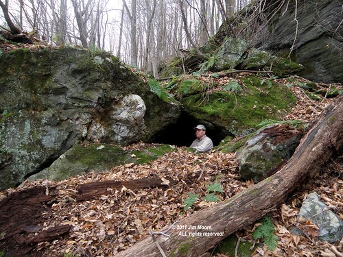
Natural stone seat at one of the Indian rocks

VERY late into the season, it is often surprising what may lay almost right under your own 'nose'. A local municipal park has a network of trails which include the remnants of a pond that once was a focal point of local activity.

But the trail map for Springside Park mentions something I had not known of previous to this past summer, the mention of 'Indian rocks' at several locations around the perimeter of the pond. I have yet to find how bona fide this 'title' might be - or just some local people having a bit of fun.

At one - the largest - of the Indian rock outcrops, exist a natural stone 'seat' that minus the foliage, can look down upon the old pond. It was here that I was struck with the fact this was a marble outcrop, later to confirm the 'e' unit of Stockbridge Marble.

Sunday, December 4, 2011

Mineralogy


Rounding out another year in the outdoors was something close to home. Cummington, MA was the location and 1824 the year. Here a mineral was discovered for the first time (other locations later on) and named for the Town as Cummingtonite. Consulting my collection of geologic maps provided to be a lucky decision as a number of fairly precise locations were given.

On this day five were considered for investigation, with at least four of the locations probably located. Several samples were collected along with some quartz and garnets often associated with sites of cummingtonite

Sunday, November 27, 2011

Back to Basics


The old Fern Cascade now known as the Falls on Roaring Brook

A fine stretch of late Autumn weather has allowed me the luxury of returning to old haunts within the Connecticut River Valley. Largely forgotten this past year, it was more due to lack of firm leads than anything else. Mountains and ledges had been gone through, sometimes a multiple of times, searching for the elusive sites photographed some 140 years prior. But the time comes to move on to new goals with the hope of returning to the old one day.

On this day however, it was time to revisit old sites Fern Cascade and the Arch on what wss to eventually be an ascent of Roaring Mountain, lying in the shadows of its slightly taller neighbor Mount Toby. Part of the route I took brought me along the original carriage road that was built mid 1880's to bvring travellers from the nearby railroad station to Toby's summit. A summit house once briefly graced the summit as well. But my path diverged up the Robert Frost Trail and on up a spur trail to Roaring Mountain's summit.

A break for lunch left me with just enough energy for a pleasant stroll down the spectactular set of ledges once know as Graves Ledge. The upper set of ledges with Graves Cave, as well as lower set with all the familar sites beginning with Castle End and running to Fortress Rock were visited. With the foliage now off for the season, a rather interesting, long range photo, of Kittie's Nook was taken.

Enough daylight was reserved so on the return trip a casual exploration in Cummington could be had. Back in 1824 a mineral located in this town was given the name "Cummingtonite". Apparently modern society being what it is today, there is more internet sites devoted to corrupting this into something of a sexual nature as opposed to it's scientific value. However, three locations were quickly checked over (including an apparent old quarry site) without seeing anything that might catch my eye as the mineral.

Sunday, November 20, 2011

Gneiss stuff!


Hikers at the Weeping Wall


Poplar Mountain in Erving MA is (as they say) the "type locale" for Poplar Mountain Gneiss. Erving Conservation Commission (with help from Mount Grace Land Trust) has developed a series of trails that presently run up to the bottom of the Mountain's summit where one can view plenty of the gneiss in the exposed ledges. My hike was with mostly local people, some from the conservation commission, and one representative from Mt Grace Land Trust.

For the following hike, I jumped south across the Millers River and on into the Wendell State Forest. A beautiful walk along a secluded brook, a view of Lynn Falls, and a climb up through the Hidden Valley Memorial Forest (once again - Mt Grace Land Trust property) brought me to some VERY impressive rock ledges. Farther along the Metacomet - Monadnock Trail, one crosses a main forest road with significant overhanging ledges and some 'quasi' cave formations. With the main gate at the State Forest entrance locked, it only remained to walk the road back on out.

Sunday, November 13, 2011

Elsie Venner


Elsie Venner's Cave

Main entrance to Elsie Venner's Cave

What to do with a late afternoon start and a diminished amount of daylight available? With no long drives possible, it is always a pleasure to return to my roots in the Central Berkshires. And one of the stories that inspired me as a child: that of Elsie Venner by Oliver Wendell Holmes.

A small cave in the broken rocks of a schistose mountainside came to be associated with that story. It was one of my early caving experiences and one of my first three attempts at cave mapping. Not a skill I totally developed as it takes as much artistry as technical know how to produce a 'worthy' map.

Little has changed at Elsie Venner's over the 45 plus years I've visited it off and on. The somewhat gray, overcast skies, of a late Fall day made ideal conditions for photographic pursuits. So I came away from my big nostalgia fix with perhaps the most 'worthy' photographs I've take here. Certainly much better than my map back in 1968 turned out.

Tuesday, November 8, 2011

Connecticut


The traditional November excursion into Connecticut took the 'scenic route' out of the southern Berkshires to make a stop at the old Rock Schoolhouse. Slightly relocated, the goal was to identify the rock in an old photograph as being the one that lays next to the former schoolhouse location. That being accomplished - I rolled on to the vicinity of Bristol and Waterbury.


The Rock...


... and the relocated schoolhouse.

Sights taken in on this day were old railroad lines, Connecticut's longest train tunnel, a search for glacial geologic phenomena at Birge Pond. The afternoon was wrapped up at the local carousel museum.

The second day saw the Finch Brook Preserve, Lake Compounce (or - an attempt to access rocky features within), and sections of the Tunxis Trail including a historic graveyard.

Sunday, November 6, 2011

On the verge of closing out another season, it is one that has been most unorthodox for me personally. The number of excursions were cut to include primarily my vacations. And, destinations were mostly the seacoast. All this was in 'the plan' but left me missing some of my more traditional haunts. So with that in mind, it's on to the rocky interiors of Massachusetts with what good weather remains.

A large postcard show out in central Massachusetts brought me into Worcester County. Afterwards, I took on a few small sights in the Town of Hardwick associated with the East Quabbin Land Trust.

Swinging northward, I passed by the entrance to Indian Rock which was mostly snowed in from the freak October snowstorm. The next destination was a back road to attempt a different access from past visits for Shelter Ledge (old Indian Cave) and Rum Rock. A fair amount of snow, and plenty of down tree limbs, made for an interesting hike to the two rocky formations. But after a long night of work, and daylight on the wane, it was time to head on home.

Saturday, October 8, 2011

Essex County including Cape Ann: The Sequel


From the glacial moraines of Peabody, Old Man Peabody

October has traditionally been spent up Essex County way and this year was no different. Essentially, it was a continuation of the September visit, this time involving (not quite) four days.

The glacial moraines around Peabody were revisited for measurements on a giant sized erratic spotted there last September. Before leaving the area, a search was made for an erratic once know to local youths as Shoemaker Rock and another look at 'access' to Pirate's Glen. I also rambled through the old Saugus Iron Works with an eye towards learning of other mill sites along that river. One is depicted on an old postcard having a huge boulder nearby. But as I discovered, many mills once lined the mighty Saugus River. Swinging on up to Cape Ann, work was continued in the Pigeon Cove vicinity. Access was checked to one of the larger quarries, and a bit of tourism in downtown Rockport.

Second day was devoted to two Essex County towns where old leads on Cradle Rock and the Nubble Squid were worked in Groveland while Parker River access and Carsey's Rock were looked over in Newbury. Both town libraries were visited.


The old Bathing Place at Pigeon Cove


The third day started in northern Dogtown but soon swung up past one big old quarry finally reaching one of the mammoth Rockport quarries. In days past it was known as the Upper Pit of the Pigeon Hill Quarries but is now a major swimming hole for the local people. Another jaunt up the coastline to Pigeon Cove for more work, finally ending at Pigeon Hill itself with the Profile Rock and checking additional routes into the old quarries.

The fourth day was to be a hot one. So some pleasant, leisurely hiking was done at the Heap of Rocks and old Rattlesnake Dens before heading on home.

Tuesday, September 20, 2011

Essex County including Cape Ann


Giant erratic on the Peabody moraines


Five days out in Essex County became somewhat evenly split between rest - and recreation. The initial stops were in the Lynn-Peabody area where Goliath Rock was the first stop. Turned out to be nothing more than a pretty average rock outcrop. The area is also home to some pretty significant glacial moraines and I continue to make significant finds along these. Included are numerous 'perched' erratics, one gigantic boulder (which I'm quite sure will rank amongst Essex County's largest), and a couple old quarry sites. Before heading out to the Cape (Ann) I finished up checking into a boulder spotted on aerial imagery. It was a possibility for the old Wigwam Rock but doesn't seem to fit the old photos and description.


The view below the old Ocean View bathhouse at Pigeon Cove


The remaining four days saw two half days out on the Pigeon Cove shoreline continuing on with the identification of historic sites and photographs. Some kayaking was found on the Little and Annisquam Rivers. Red Rocks was hiked. A drive by was made on Sea Rocks the old Estate of Jacob Loose. A couple of the old Rockport quarries and another quick trip into Profile Rock rounded out the tour.


The Headlands at Rockport

Parts of this - and other recent vacations - have been spent laying the groundwork for future sea going investigations which will only grow with time.

Thursday, August 11, 2011


Cleft Rock (as 'House Rock') as it appeared in the early 1900's

Some good presented itself as I was about to begin another vacation. It appeared I might be able to get my 'travel boat' back on the water again. So this spoke loud and clear about returning to coastal areas. I decided to put part of a day trying to pick up where I left off in Newport, Rhode Island.

But it was not meant to be as upon my arrival the area was shrouded in fog and the seas - just VERY choppy. So after a morning of casual sight seeing, I rolled on up to the area of Fall River for further investigations into Rocky Woods where old King Philip (aka: Metacom) once use to roam.

The second day brought me out to the South Shore coast of Massachusetts, an area I have spent much time over the years. Wanting to keep things on the 'light' side I proceeded to work a series of old leads and sites. First stop was the Cleft Rock near Manomet. Many years since I saw this intriguing split rock formation.

Rolling up the coast I continued on with the investigation of a Devil's Rock. This town reportedly had at least a couple, along with a couple more rocky formations named for old Satan. I'm not altogether convinced this rock that I got a second look at is the real deal. Some scratches (probably glacial) but I don't see 'footprints'. However, it is impossible to tell how much imagination the local people in Colonial times used in seeing these phenomena. But it seems I'm getting closer, as the the rock written of in local history, was in - or near - an old brickyard. There are old bricks here and a hand-drawn map found a couple years back, marks the brickyard as very close by. Likely coming in by river may be necessary.


King Philip's Rock


Library visits were made intermittently as a bit of relief from the scorching heat. After once such stop, I continued my trek up the coast dropping in again on another King Philip's site. This was also to check a legitimate access route across conservation land where previously I had to ask (but much shorter) to cross neighboring territory. One note: this particular King Philip's Rock has one reference to being Pulpit Rock.

Still farther up the coast: low tide, The Nubian Head Rock, a library, and some reconnaissance to see if some type of access might be had to another Cleft Rock written up in local history. Although I have repeatedly tried this many times over the years, the feeling is of being completely stymied. What would have been perfect access, was an old railroad bed. However, recent years has seen that railroad reactivated. The rest of the area is covered with residential neighborhoods and swampy meadows.

The same can mostly be said of nearby Sunset Rock. Once the place to obtain beautiful views, It now has the same railroad line below it, and residential backyards bordering its opposite side.


Landing Rock


On the third day, I sat sipping MickeyD's coffee while waiting out some foul weather that had moved in the previous night. Eventually I took to the coast examining a number of rocky sites but also with an eye towards some possible water access routes. I came on in by Kent Rocks, but soon found access to a local river a bit inland where finally I could pull out the kayak. Sailing the lowering tide towards the ocean, I passed a number of fine rock outcroppings. One towering monolith was later identified as Buck Rock. On the return, a trip down a side inlet brought me to Landing Rock where baptisms once took place during the 1800's.


Landing Rock: early 1900's postcard


The fourth - and final day - was planned to be a light one. Having secured knowledge of a kayak access point from a local individual, I set out for the Indian Well, Indian Pot, and other glacial potholes. Although these are suppose to be along the shoreline - they never were seen.

Monday, August 1, 2011


The Gulf by Lower Cave - 1923


Summer heat is here for the foreseeable future so we work minimally. I'm presently trying to come up with a good method for scanning glass slides and negatives that are beyond the normal size a scanner will handle. Think I may found some success there. This also involves taking me to the nearby Gulf to compare my images from 1923 with present conditions there. Some modern day changes to the landscape may make some identification impossible.

However, a major segment of my vacation time approaches and time to ponder its course. If I am able to return to being on the sea - far from certain - that will play a major force in my decision. If not - well it's the usual land based activities.

A new kayak is being 'broken in' but this will be only for local recreational use. It has already proved it's usefulness with my first ever water tour on parts of Onota Lake. Here the long sought after Pulpit Rock was finally found.


Pulpit Rock @ Onota Lake - early 1900s postcard

Saturday, July 16, 2011

Sifting through history


Mary Constance Todd at the 'Gulf Rocks' aka: Wizard's Glen. 1923.
Lucky 7 Cave entrance to the lower left.

Recent projects have involved sifting through enormous amounts of old photographic material. Eventually this will translate into a large amount of field activity. I've been helping out the Granddaughter of Frank DeMars with identification on some of her Granddad's old photographic images. Frank was a prolific photographer and postcard producer, mostly active in northwest Connecticut and southwest Massachusetts.

My own collection has grown with the addition of photographic negatives. First of the Oven Mouth in Norfolk County - circa 1930's. Second are a few glass slides from the travels of Mary Constance Todd and her husband to the East Coast during 1923. I have obtained those of Mary's visited to the "Gulf Rocks" or what is better known as Wizard's Glen which includes Lucky 7 Cave, amongst others.

Thursday, June 9, 2011

The Ocean


Cave formation - Newport vicinity

Five days out on the road evenly split between the Newport, Rhode Island area and Cape Ann. This was intended to be primarily a seafaring adventure, but problems, both moderate and severe, beached me early on. So some of the time in the Newport area was spent trying to resolve those issues (unable) and the rest - more like a normal tourist.

But before problems sent me to shore, I was able to explore the area of Purgatory, revisiting Negro Head, the adjacent Lovers Pass, some small cave formations, and finally entering the interior of Purgatory itself. Some of the aforementioned problems were temporarily resolved to allow me to investigate a reported cave site on the east side of the Sakonnet River. Shoreline visits were also made to the vicinity of Profile Rock and Pirate Caves Also: a marvelous hike in the woods of Tiverton to High Rock while waiting for low tide on the Sakonnet River.

Before pulling out of Town on the third morning, I went off to old favorite in the 40 steps at the Cliff Walk. Photographed here were more historic sites that have surfaced in antique photography.


Dick's Dream overlooking the Atlantic


On into Cape Ann, camp was set up to prepare for an early morning call next morning. That call brought me back into examining old quarrying activity in Gloucester. Also being the site of the Chief Wingaersheek formation. Breakfast with an old friend charged me up to take on the Rockport shoreline. What ensued was six plus hours 'cooking' under the sun while slowly making my way up the rocky coastline visiting, and confirming, historic sites that included the Swimming/Bathing Place, with its marvelous Stone Bathtub, and Pulpit Rock. Along the way I once again got a gander at the sites visited - and passed - during April including Cathedral Rocks, Singers Rock, Chapin's Gully, finally ending by Dick's Dream. Spouting rocks abounded and a marvelous pegmatite deposit exists among these rocks. On the return, I was stunned to see the previously, nearly empty, Stone Bathtub completely submerged. Ah - the power of the mighty tides!

Fifth and final day brought intense heat. I weathered it for a short duration, returning to the Stone Bathtub for more photos and to examine it during its emptying phase. One final trek was made through the sun to visit the Halibut Point shoreline and a couple sea-boulder caves.

Tuesday, May 10, 2011

Indian Rock


Indian Rock

Over the winter an interesting antique postcard surfaced revealing a view from "Indian Rock" in Dalton, central Berkshires. Although the image did not show the rock itself, I did not let that discourage me from searching out the location of this heretofore unknown (to me - anyways) site.

Using a former Appalachian Trail access, I worked my way into the area that would possibly line up the view seen in the postcard. It did not take very long to come upon a large glacial boulder with a nearly smooth, level surface. Certainly would make for a good meeting site. And - another source had mention a "Meeting Rock" in the general vicinity, that also having a Native American background.

Reconnaissance of the area both before - and after - the photo session, revealed nothing more than that several token, small erratics. Nothing on the order of what I assume to be Indian Rock.

On the hike back, I scouted the old AT route but it has all been obliterated in recent years. But down near the Housatonic River, I discovered an old dam site that had been breached in the attempt to return the mighty river to its more natural state.

Wednesday, April 20, 2011

Essex County/Cape Ann


Spring has come very, VERY slowly. Good days seem all too far and few between. But a roll of the dice and on up to Essex County to see how far I could go.

Day One: Working information that surfaced just after my last visit to Essex County, I trolled through the moraine containing Ship Rock in search of Kimball Rock. A few good sized boulders were encountered, although nothing nearly equaling the size of Ship Rock. At a location marked on my source map (albeit: somewhat of a small scale) the 'largest' of these boulders was found and I assume this to be Kimball Rock. Now to determine the source of its name.

Lookout Rock (mentioned as being a boulder) was given a second go now that a more definitive location was found. Several erratic extended from the crest of a hill downward. The largest, at the top, was assumed to be Lookout Rock. However, views were mostly obscured due to newer growth. A nearby outcrop along the hillside offered just a slightly better view.


Lookout Rock

With a bit of time to kill, I quickly drove up the interstate into the more northerly portions of the county to try once again and identify the Ordway Boulder. A local history expert verified, on my last pass through the area, it would be in the same section of woods as the previously visited Haystack Boulder. Still no luck on this one and seeing the property is being carved up for development, I have to wonder how long future visits may be possible.

Day Two: Early morning and time to roll on to Cape Ann and Pigeon Cove. Very quickly gaining access the sea shore rocks, I began the process of identifying sites from old images. Chapin's (Great Gully) is well know, down to Singer's Rock, and on to Cathedral Rocks and the Bathing/Swimming Place. Reversing direction, I passed the Gargoyle, and looked extensively for a much sought out prize: Dick's Dream. I got up as far as the Frog (completely swamped by a ferocious surf). An abundance of marvelous dikes were to be seen along the way, but could not find what Dick might have been dreaming of.

Drawning of Dick's Dream from "Pigeon Cove and Vicinity" 1873

Coming down the coast, I was pleasantly surprised to find a rock depicted on an old postcard of Pigeon Hill. In one version of this postcard, it is called Profile Rock. A somewhat marginal example of this phenomenon. But there it was, once standing proudly against the backdrop of the vista below, now surrounded by the growth of recent generations. Down below, I took in the sites available from the Granite Pier.

One longer hike out to the Devil's Den, and a short jaunt on the Old Rockport Road, finished the day.


Part of the 'Devil's Den' outcrop

Days Three and Four: Ah - the almighty rains rolled in over night but were light enough for me to slip out in the morning to the very rocky Poles Hill. The next morning saw very slight improvement, so I ran with it, stopping off at the Stone Chair and swinging up and around Halibut Point to Pigeon Cove once again. Despite the constant threat that rain would descend upon me, I went back out on the rocks in a slightly different area from two days previous. I came back by the Frog, spied something that looked like Dick's Dream, but gave it a thumbs down on my previous pass by two dys earlier. Not having my printouts with me, I shot a couple of photos to look over later.

Meteoric Rock was listed on the back of an old stereoview as being among these rocks. One local, theorized it to be an elevated gabbro dike which I did find. However, without the actual photo - it's hard to complete the identification. I worked back down the coast to photograph (again) Singer's Rock which had been washed out by the sunlight two days previous.


Singer's Rock: circa 1870s - above; and present day - below.


I usually like to include a Dogtown hike on each visit, but threatening weather made long treks out into the open iffy at best. Finally a decision was made to go for the Briar Swamp area and Racoon Rocks. Destination reached: the rain started slow and steady. So retreating to the car, the long journey home was made once again.

Saturday, April 9, 2011

Pocumtuck


View out of King Philip's Cave

A pretty straightforward visit to the Connecticut River Valley. I decided to take in a postcard show in Greenfield then head South down the Valley and see how far I could get. Not too far really, but considering this was after working the whole week previous and all night too, I got in a nice trip.

The afternoon was spent hiking the southern end of the Pocumtuck Range once again ending at a small cave formation that has been called King Philip's Cave. It is but a small alcove eroded out of the Sugarloaf Arkose but it comes with spectacular views of the valley below.

Sunday, April 3, 2011

Return to Wachussetts


Cave formation in north-central Worcester County

The weekend start off with a brief jaunt to the central Berkshires. This was to give my cameras a 'test run' after the long winter layoff. It also gave me a chance to look over a rather large boulder mentioned to me by a co worker. Afterwards a drive along the back road confirmed plenty of snow still on the ground as well as sections of rock that looked to be from the mountain looming behind. Final destination was good old Reynolds Rock, a fine photographic test, standing amongst the snow still spitting from the previous day's northeaster that never fully materialized.

Sunday started in earnest as I was out in central Massachusetts as the sun rose. The first destination was way out in Middlesex County - the Boston Antique Photo Show. A couple hours here was enough before moving on to the area in and around the Wachusetts Reservoir. I basically worked the area visited back in February when snow and wind were the order of the day. First sought out was an Indian Rock first visited some years back. It apparently is now a decoration in front of a newer home.

Off in the nearby woods, I worked the story of two Tory Caves. Like many stories of history, there are discrepancies as to location. In the past I looked at one location which was basically a bit of a ledge outcropping. No cave passage of any sort. But I was told a new location might hold more promise. After a walk through the woods, and some intensive searching of ledges and glacial boulders, little was to be found. Possible two overlapping erratics might provide a bit of shelter. I confirmed my observations with two young men I ran into and then looked over a monstrous sized boulder before moving on.

Over on the other side of Wachusetts, I returned to the "Clamshell Cut" which was the site of several old postcards including one dubious "Profile Rock". There have been some minor changes to the walls of this rock cut, including a 'knob' that I imagine once was the nose for this very minor profile feature.

Continuing on , I dropped in at the Rowlandson Rock - or Boulder - site of where Mary Rowlandson was said to have spent her first night in captivity during King Philip's War. From there it was but a brief drive over to examine some rocky cave formations brought to my attention by a local man posting them on his internet photo site.

The day was finished up on a section of the Mid-State Trail where the Everett Tomb is located. Now where did that tomb go? I saw it once a few years back. Ah well - next time. Darkness was moving in and it was time to catch the Mohawk Trail back to the Berkshires

Saturday, February 12, 2011

Wachusetts!


The 'Wachusetts Profile' circa just after the Reservoir's completion

A mid winter break took me out to the farthest reaches (from my perspective) of Worcester County for a lecture on the history of the Wachusetts Reservoir. Much has been written regarding the much larger - and later built - Quabbin Reservoir but this is the most comprehensive gathering of information I've seen on Wachusetts.

But since it is a bit of a drive for this individual, I thought I'd try to mix in a little project work along the way. It was met with only moderate success as snow and biting wind turned back attempts at reaching most sites. But one pleasant surprise was a local library within the region between the two great reservoirs. Here the origin of a mysterious postcard "Everett Tomb" was investigated. By the time I left, its story had been partially explored. But being off in the woods, the time for a physical visit will have to wait.

Moving along I tried to get in to Rowlandson Rock and a railroad rock cut that has several postcards of its likeness, including one "Profile Rock", but here's where weather got the better of the situation. Even the local Profile Rock along the main highway was encrusted within an icy robe. Arriving in Town for the lecture I first scouted out their local library where information on a local Tory Cave/Bear's Den was found. The presentation went off without a hitch and I even reconnected with Fred from the local historical society whom I met on a couple occasions in years past. Fred has - and continues to be - a very valuable source of information on the local area.

Lecture finished, it was time to wander north to the Mohawk Trail for the return home to the Berkshires.