Friday, November 9, 2018

Sliver of a Chance


Several years ago a small cave was discovered in the southern Berkshires. This would normally not cause much of a stir, but what resulted was of modest interest. The 'cave discovery' was in a geologic formation know as a 'carbonate sliver', which, in this region, is a portion of marbles usually surrounded by insoluble rocks.

Analysis of the local bedrock geology maps, revealed several other of these 'slivers' in the area, including a previously known cave off to the north. Today was the day devoted to examining those other slivers, plus returning to the cave I visited once before - probably around 50 years ago. So starting our trek, Rhode Island Mountain Man and myself, first passed by a flooded Carbonate Sliver Cave (recent discover) on to the north. Out in the middle of nowhere, we examined the location of two slivers, lying in relatively close proximity to one another. The first showed almost no exposure of rock - the second, an insignificant depression adjacent to a sharp hill, being the sliver itself.


Mike tries to extract himself from the cave's depths

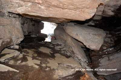
Following the drainage north from this sliver/hillock, we eventually arrived at the sliver containing the 'major' cave in the area. Unfortunately, the perimeter around the cave was feeding significant water to the underground. Although access was gained to the cave's entrance room, the passages beyond suffered from fill.


Banded marble. Wet interior.

The journey out provided at chance for a further examination of the sliver with little rock exposure. Back near the beginning, we looked down into the flooded passages of the more recent discovery.

Later that week, we dropped down into northern Connecticut for an attempt at finding the elusive Dutchy's Cave. The large flows of water that were noticed earlier in the week were even more omnipresent. We had a number of stream crossings to make and it was made difficult by these water levels. Much trudging about did not gain us our goal. We did have the pleasure of passing by Turtle Rock, on the Naugatuck River, during the journey.

Sunday, September 23, 2018

Rockin' the North Shore


Small cave formation within Franklin Park

Back out on the road less than two weeks after my last trip ended. It all began on Day One with additional time put in on places visited during that previous trip. This was areas in the outskirts of Boston. It all began with a return to Hemlock Gorge and its Devil's Den/Indian Cave. Then swinging less than 10 miles (as the crow flies!) it was once again Mattapan where a more careful examination was made of the boulders first seen two weeks prior. It included combing the grounds for additional geologic treasures and I was rewarded with the discovery of a second large deposit of Roxbury Conglomerate boulders. With a short time remaining to get out of the City before rush hour traffic, I backtracked a bit to make a quick excursion through the Wilderness section of Franklin Park. Again, additional boulders of conglomerate came to light and the rediscovery of a small cave first seen some years prior.


The Devil's Pulpit - and possible Whitefield pulpit

My ultimate destination was the favorite campsite on Cape Ann and my 'trusty' GPS decided to give me a tour of some of the most urban parts of Boston, prior to taking me out of the city. But by Day Two, I was ready to continue the travel up into the more northerly sections of Essex County. Here a more thorough examination was carried out of the Nubble Squid rocks, part of the Clinton-Newbury Fault. An old favorite was next at the Devil's Den and Pulpit, followed by the diminutive rock Bummers Rock before finishing this day at with a lead hanging over from long ago: Frazer's Rock.


Frazer's Rock - very early 1900s.


Dungeon Rock @ Lynn Woods.

Kicking off the Third Day, I wandered down to an old favorite hangout in Lynn at Lynn Woods. This was mostly to update information on several sites, some well known, and some not so well known. Here, I covered Dungeon Rock, Union Rock, and Forest Castle. An old 1890s map found upon my return home, makes it clear there are many more objects of interest to be found. Wandering through Lynn, I took a quick look at a street with the name Echo Grove hoping it might provide a clue to an old stereoview of a location bearing that name. Once again, additional research provided the information it was another site within Lynn Woods. This day was finished up at Lynn's Lovers Leap.


Lovers Leap.


Lovers Leap - circa 1870s/80s.

An intentional light duty day was planned for my Fourth Day so I stayed closed to camp catching the famed Pigeon Cove shoreline, lunching at Lanes Cove, at finishing down by the Blackburn entrance to Dogtown. Here I updated photos of Tent Rock, a somewhat little know quarry down near the reservoir, and visiting five of Babson's inscribed boulders: Be True, Be Clean, Save, Help Mother, and Get A Job.


Ship Rock - early 1900s postcard image.

Day Five brought us once again to the end of another camping trip. Pulling out of town, I headed down Rt 128 to land in Peabody. Here, a visit to a very favorite at Ship Rock. After that, I stuck to the same moraine as Ship Rock to investigate possible boulders discovered on aerial imagery. Some very huge ones, exceeding 100 feet in circumference, were located. Definitely some of the best discoveries to come out of this area in years. Then eventually on to the Mohawk Trail to make my way back to the Berkshires.


The BMW Boulder. Over 100 ' circumference and 16+ feet high.

Friday, September 7, 2018

Quonahasset and other "long rocky places".


Memories of old resurfaced when September would bring me to the South Shore. One of my favorite campgrounds is here. Some of my 'rockiest' exploits have take place in this region. But with the passing of time (and ongoing process of checking items off my list) a somewhat different approach takes place! I needed to also visit the Cape and almost opted to make a second camp there. In the end, all excursions were run from seashore area of Plymouth County. And - a total of seven different counties were visited!


The Devil's 'own' footprint - along side that of a human.


One of the largest erratics on the South Shore.

The traditional 'scenic route' started day one with a couple stops along the Charles River in Norfolk County. This allowed me my first look at Big Rock, and a return for further investigations at Indian Cave. A couple minor rock samples were brought from the later to run an elementary geologic test. It was then on to Bristol County for a quick trip to the Devil's Footprint, the largest sized of this formation I've run across. Then it was on to the coast where a second look at the gigantic Damon's Rock took place. Following that, camp was set up and I still had enough time to take in Glad Tidings Rock.


Modern times @ Profile Rock.

On day two it was decided to take that planned trip out to the Cape, so a lot of driving lay ahead. Early morning started down on Buzzards Bay at Profile Rock. This relic from days gone by is mostly buried now by beach sand. Still: approximately 40% survives above ground level. Proceeding closer to the Cape Cod Canal (where some say is the 'official' beginning of the Cape) an old favorite in Chamber (Sacrifice) Rock began the Barnstable County part of my day. From there it was on to Hokum Rock and The Pebble/Devil's Rock. Sandwiched in between the latter two, was finally locating Alms House Rock. Alms House is another giant boulder that likely lays partially buried so its true height remains a mystery. It is mostly surrounded by heavy growth making measurements and photography nearly impossible. But I came up with something around 67 feet circumference and 14 feet high. Next time I shall bring the brush cutters!


Modern day depiction of 'The Cave' - aka: The Devil's Den.

After the heavy amount of driving during the last two days, I decided to keep it close to .. ' 'home'. Once again, this involved my traditional mix of 'something old - something new'. Early morning found me hiking into a small cave I've come to call Rattlesnake Den. Local history mentions a rocky formation by that name but it's location would be a bit farther away. I followed with a half-hearted attempt (drive-by only) to see if Sunset Rock might have a secondary access. One that would not take you through the backyards of the two owners. However, it is basically tucked in between the housing development and the railroad tracks that carry traffic between Boston and the South Shore. This was followed by Lawson Park and its memorial boulders (one of which is depicted on an old postcard), a couple quick photos of Hatchet Rock, and a quick drive by of Toad Rock. This then landed me on one of the most beautiful sections of South Shore coastline where a walking tour ensued to access the Old Man of the Rocks, Pulpit Rock, and Devil's Den/The Cave. After 'cooking' out in the hot sun it was a drive past the likely Aunt Betsy's Rock.


Tunnel Rock.


Outcrop with Emerson plaque @ Franklin Park.

A little farther distance on day four brought me close to - and into - the suburbs of Boston (thank God for the GPS!). A long return to the giant boulder in the Blue Hills once know as Grepon. It is around 100 feet in circumference with heights as much as 22 feet on the backside. There is also a neat little talus cave (10.5 feet long) in the rubble at one end. Next stop brought me to Franklin Park where I've had ongoing investigations into features from its past history. A more expansive trip was made through the area between the Wilderness and 99 Steps to seek out a possible Sunset Rock and additional perched/balanced boulders. Then across Circuit Drive to look into the rock and Emerson plaque at the Overlook on Schoolmaster's Hill. The walk back to the car was via a route through small ledges that are reported to be the remains of a quarry (now filled) that has been on a postcard as Lovers Leap/Bottomless Well. The 'gem' of the day was a jaunt over to Mattapan where a large accumulation of Roxbury Conglomerate boulders yielded the forgotten Tunnel Rock. I am also hoping the lost Fairview Rock (with the location 'Neponsett' [sic]) may lie nearby.


View out of Makepeace-Manly Cave.

After a rainy night, I broke camp and moved on out to the beltway around Boston to make a quick trip into Hemlock Gorge and it's Devil's Den/Indian Cave. Not feeling up to snuff, I planned to head home from here. But a good cup of overpriced Turnpike coffee got me ready to take on one more high value target! The stop was way back in Worcester County where I pushed on through some nearly impossible overgrowth to Makepeace-Manly Cave. This small cave formation is notable for it's inscriptions from area residents during the 1800s.


Inscriptions @ Makepeace-Manly Cave.

Friday, August 24, 2018

In Search of Caves!


Today's goal consisted of three sites in the southeast regions of Hampshire County. With an option, if time permitted, to wander up a bit north into Worcester County. In the end I had one success to show, from the primary three, before time ran out. However, it was a worthy find and the other two will be ongoing projects.

The initial stop took me into an area south of the Quabbin Reservoir, and west of the Swift River, in search of a small cave with 1800s initials carved into its walls. Besides the historical aspect, I've been interested in looking at small, weathered-formed cave formations in central Massachusetts. The purpose being to see if any similarities between them might exist. This was my second attempt in the area to locate this particular site, and again, it was not to be. But hopefully , through a process of elimination, a future visit will indeed bring me to its location.


The 'lost' Crystal Cascade

On the way farther east to do a bit of a long hike into a 'better located' cave, I made a pass by an area I suspected might be the site of a cascade shown on several old postcards. The road was narrow and dangerous. Parking nonexistent. And looked pretty much like private lands. So without additional information, it was decided to pass on attempting a hike into these woods.


Looking out through Boy Scout Cave

Finally, I arrived at what I hoped to be a worthy exploration: aA moderately long - entirely hot and buggy walk - up hill into the wilds of the Hampshire-Worcester County border. My final destination - Boy Scout Cave - was indeed located! It exceeded what I had expected! Not a weathered cave formation but the result of fractured bedrock and the dislocation of some of its sections. The cave could have potentially made a nifty Native American camp at 20 feet long and around 8 high. it is south facing and has a stream almost at its doorstep.

All-in-all, I think the general area leaves a lot to explore!

Friday, August 10, 2018

Overgrown pastures and Quarry Woods.


I'll preface this by saying the summer environment , dealing with the bugs, was horrific! BUT with a bit of history, the geologic background of Western Massachusetts, and a road trip: we had all the ingredients for another adventure.


Big Rock - as depicted on this real photo postcard late 1920s to 1940s.

Toting along a recent find of a real photo postcard, I descended down into the farthest corner of Hampshire County. My postcard did not identify the site by name, but the location written on the reverse side told me it was Big Rock, sometimes called Great Rock. I've seen this boulder a couple times previously but in my mind the photo just did not seem to match! Upon arrival (and scrambling through bushes) I did quickly confirm this postcard to the site. With foliage in full bloom it was much more challenging to come up with a good photograph as opposed to previous off-season visits.


Another side to Big Rock - depicted as Great Rock. Late 1800s.


Big Rock/Great Rock as it appears today!

Since I was already in the area (and dirty and bitten up) I went on over to the local soapstone quarry. A MAJOR operation in its day, this site shipped stone down as far as New York City. Now, just a massive rift in the Earth, it lies abandoned except to those who know where to look.


Entering the old soapstone quarry

Friday, June 15, 2018

In Search of ...Boulders!


Catching up again with 'South County's Finest', Gary L., the purpose of this trip was to hopefully locate Meetinghouse/Town House Rock in northwestern Connecticut We also had information on other boulders, from a town website, and planned a return to Tipping Rock.

It all began with a hiking trip to the top of Haystack Mountain where a pre WPA era stone tower is located. The descent took us past a couple of small quarries that had provided building material for mountain construction projects.


Quarry - and stone tower (background - obscured by trees).

Moving on, we covered several more area sites reported to have boulders, even a "gigantic" boulder, and a reported Sheep Rock. These all yielded absolutely nothing. A search was then started for the 'prime objective': Meetinghouse Rock. Two different sections of the old roadway leading to a long-abandoned town associated with the boulder, but we came up empty-handed. We did visit a splendid erratic recently discovered on a recent trip by Gary and a smaller one I found during the day's search.

A 'stone's throw' to the south (and a moderate walk) brought us back to Tipping Rock. A fine example of this type of phenomena. We first visited this boulder back in the Fall of 2014.


Thursday, May 10, 2018

No Place Like Home!


It always good to return to one of my "home-away-from-homes", this one being the Cape Ann area. In more recent years, the route to and fro have taken on a more 'circuitous' path as I still have many sites in need of attention with a lesser accent upon Cape Ann sites.


An unidentified 1901 image of Balance Rock

So on Day one of this adventure, I started by a long overdue visit to the Balance Rock Farm in Worcester County. A little over a year ago, I came upon some old photos showing the Balance Rock and other local sites. After checking in with the farm's owner, and once again visiting the namesake rock, it was on to a neighboring town and it's own local version of the Profile Rock. Frome here, it was deeper into Middlesex County for glacial boulders at the Landlocked Forest (which bumps up against the Boston Beltway highways) and a revisit to the nearby Paint Mine location. Finally, late in the day, it was time to swing on up to Cape Ann, checking for possible rock/Indian shelters (nothing here) and a walk through the Red Rocks climbing area.


Rayne Adams Boulder @ Dogtown

I originally planned the morning of the second day to be split between Dogtown, and reach the seashore for other projects, just before noon. However, Dogtown had me tied up all morning visiting locations in its northwestern perimeter. These included the Rayne Boulder (gravesite?), Peter's Pulpit, Whales Jaw, Wharf Road, Dogtown Square, and the Merry/bull attack boulders. Later on, I continued a casual, leisurely pace, once again investigating possible rock/Indian shelters, Rockport's Emerson Plaque site on Andrews Point and Profile Rock.


Peter's Pulpit - late 1800's Magic Lantern Slide

The morning of the third day was an abbreviated jaunt to more northerly sections of Essex County to finally bear fruit on a long ongoing project: location of the Nubble Squid which was mentioned in John Henry Sears' 1905 book on Essex County geology. Over the years, numerous searches of various locations were undertaken but produced minimal results. This significant rocky area (which I've read is part of the Clinton-Newbury Faultline) only got a quick, casual look, before returning to Gloucester shoreline for low tide. Down at the seashore, I explored possibilities (but nothing definite) for the Old Man's Cave (antique image) and a look at the nearby, very small, sea cave. Afterward, it was to the location of the Old Man of Joppa formation to try and get a more definitive confirmation on this site.


One of the entrances to the Old Indian Cave


Appleton's Pulpit - early 1900's postcard


The fourth day once again brought me off the Cape, down to the Saugus vicinity. Here I looked into the Old Indian Cave, a balanced boulder, Cannon/Phaeton Rock, Appleton's Pulpit, Shoemaker Rock, and the Pirates Glen.


Shoemaker Rock


Day five saw me pulling out of town late in the morning after breakfast and a seaside walk. Down to Woburn for Rag Rock then on to Fitchburg's Cogshall Park. Although I did visit Moses Rock, there are other features here than needing to be examined. Picking up the Mohawk Trail, it was westward on to the Berkshires!

Thursday, April 26, 2018

Success!


Ah how sweet it is. Success! Several years ago a couple of old postcards (reputed to be the same location) came to my attention. Along with (one of) Great Barrington's finest, we attempted to track down this site. Several failures were encountered along the way until an internet discussion brought valuable clues. So finally with Spring here, we set off with great hopes to finally visit Tramp Rock, possibly known as Weary Willy's Haven of Refuge.


Tramp Rock, as seen in modern days.

Access proved to be a bit tricky as I had to wade a swift current across a somewhat deep river. But just inside the woods, on the opposite shore, the prize was waiting! A massive glacial boulder surrounded by many other smaller ones. The story here is that it may have been a hobo camp long ago when a nearby railroad line ran through these parts.


Tramp Rock from an early 1900s postcard

An added 'bonus' to the trip were visits to several other nearby sites including Point of Rocks, Cemetery Ledge, and the old Beckley (iron) Furnace.

Tuesday, April 24, 2018

Tri-State Romp


Starting off four days of beautiful weather was one of the eminent geologic features in all of Massachusetts: Purgatory Chasm. Although I have visited it several times in the past, my more specific goal was the location of a lengthy cave I call 'Fish Diet Cave' - or aka Damnation Cave. I took the opportunity to visit most of the major features in the Chasm and update photos on some of them. A couple of the smaller caves I have not visited in the past were also explored.


USGS file photo of pothole in the Blackstone Gorge

Unable to locate Fish Diet, I moved on to the mighty Blackstone Gorge where high waters made for an impressive site! Downstream from the Rolling Dam, the river eventually enters the George with high rock walls. One has been depicted in the past on a postcard as Lovers Leap. A massive boulder in the river is also known for the king-sized pothole that runs through it. Before leaving the Woonsocket area, I made a trip to look the Cold Spring which sits in a park by the same name.


The Cold Spring


A likely King Philip and H P Lovecraft site overlooking the Pond

Next up was Lincoln RI whose Lincoln Woods boulders are a favorite amongst climbers. I concentrated on northwest portions of the park where I wanted to take a stab at identifying an old photo as well as photographing a minor cave formation. In the nearby settlement of Lonsdale, the Indian Red Rock was given another look after many years to see if it could be matched to its old photo.


The Wolfs Den, as portrayed on an early 1900s postcard

Day Two started off by connecting with RI authority, Mike G., from whence we proceeded down into the southwest corner of Connecticut to take on Wolfs Den. Then it was all the way back up to northeastern Rhode Island to see Bigfoot Cave, the site of the mineral Cumberlandite (state rock of Rhode Island), and the possible site of an Indian encampment: Mollie's Bedroom.


At the main entrance to Bigfoot Cave


Leif's - or Norseman's - Rock

By the third day I was back traveling solo making an early morning excursion to Rocky Point Park. This was a relatively quick trip, seeing the shoreline, catching the image represented on an old postcard, and a stroll past the cave formations located nearby. Hopping across the upper end of Providence Harbor/Seekonk River, I was able to make a mid-morning low tide at Leif's/Norseman's Rock before returning northward to Massasoit's Spring.


King Philip's Cave (above) from an early 1900s postcard


King Philip's Cave - modern day

Back into Massachusetts, I took a quick look at conglomerate outcrops in the area of Luther Corner before going on down to Fall River at Creeping Rock. North again to King Philip's Cave and a look at future water access to someday visit Gary Rocks. Moving on to the Foxboro State Forest, I attempted to look up a letterbox, mostly because its description included the 'stone face'. This proved unsuccessful, so off I went to the Wrentham State Forest to Boulder Cave before retiring for the night.


Boulder Cave


The likely Cart and Oxen Rock

The fourth day was somewhat abbreviated doing more rocky formations in Wrentham, which included a likely success at finally locating Cart and Oxen Rock, a couple caves, and a giant rock pinnacle. From there, another quick run was made into Purgatory Chasm in a final attempt to locate the Fish Diet Cave. Once again - no luck. But maybe next time!


The Pinnacle

Onward home!

Sunday, April 1, 2018

Across the Wide Connecticut!


From time-to-time over the years, I've mentioned a large-scale project taking place in the mountains across (east) of the Connecticut River. I've also touched upon the fact, it is largely on hiatus due to a lack of information. But every so often, a little bit of something new dribbles in and breaths new life into it! So on Easter Sunday, I began the 'rebirth' of a new season by making that trip.

The general area under examination, are rock-cut terraces and cirques whose erosion have provided some of the most spectacular rock formations across Massachusetts. They were often visited, and fell under the keen eye of a local clergyman and photographer, during the 1860's. On this day, the section once known as 'Home of the Rocks' was the objective. A couple previously unknown antique images were uncovered, and I hoped to continue on with the identification and photographing those sites, along with others already found.


The likely Cozy Cave

The first stop was 'Kitchen and Pantry', (the likely) 'Cozy Cave', followed by the 'Curve Rock', under the 'Rock Shadow' and out into the 'Grand Porch'. The area below the Porch is 'Titan's Pasture', with the immediate area containing several caves formed by frost wedging/gravity assist. Weathering has also left massive rocks that long ago peeled away from the ledges and a few caves might also be found here. Just beyond the Pasture we run into the 'Bear's Den' and 'Kendall's Recess'.


Kendall's Recess: circa 1870. Bear's Den: lower left

After finishing photographic work in this area, it was needed to re-locate (whatever happened to my GPS coordinates?) the Devil's Pulpit and Cave. This colossal block of rock has moved away from the parent ledge but still remains physically connected. However, a cave was formed by the vacated space.


Looking through the Devil's Pulpit Cave

This much climbing on rocks and ledges is probably best suited for a bit younger individual. So after a long half-day, it was time to bid farewell till next time.

Sunday, March 18, 2018

South of the Border


The term "Scenic Route" can mean more than a well-intentioned definition for a much longer journey. The Route 8 corridor from Massachusetts into Connecticut has provided many fine, scenic memories - and explorations - over the years. In recent years: Church Rock, Hanging Mountain, and two enormous boulders at Otis and Sandisfield. South of the Border: Schoolhouse Rock, Jumbo Rock, and an unsuccesful search for Pulpit Rock.

On one bitterly cold Sunday morn, I made my way down that highway for a "meeting of the minds" (or what I like to call a "Geeks Convention") to plow over maps, exchange ideas, and enjoy some good company. Yes - the time honored tradition of rolling out the paper maps did take place, and we were able to leave one another a little more informed regarding our mutual interests in caves, geology, and archeology.


McCaffrey Falls in the southern Berkshire region

The trip home afforded the opportunity to make a couple quick stops, one being the Colebrook River Lake to check on the water level. Apparently the old town bridge, that had been left behind after the Army Corp project, was finally removed. I got in two photo opportunites just a bit farther north at a roadside waterfall and a giant rock in Sandisfield. The waterfall is apparently the same one depicted on an old postcard as McCaffrey Falls, but nowadays is generally known as Marguerite Falls.


Giant boulder in Sandisfield awaits the Spring